
Fájl:Distribution of US Rural Population during 1900.pdf

Ennek a(z) PDF fájlnak ezen JPG formátumú előnézete: 800 × 535 képpont. További felbontások: 320 × 214 képpont | 640 × 428 képpont | 1 024 × 684 képpont | 1 280 × 855 képpont | 2 472 × 1 652 képpont.
Eredeti fájl (2 472 × 1 652 képpont, fájlméret: 61,4 MB, MIME-típus: application/pdf)
|
Ez a fájl a Wikimedia Commonsból származik. Az alább látható leírás az ottani dokumentációjának másolata. A Commons projekt szabad licencű kép- és multimédiatár. Segíts te is az építésében! |
Összefoglaló
| Leírás |
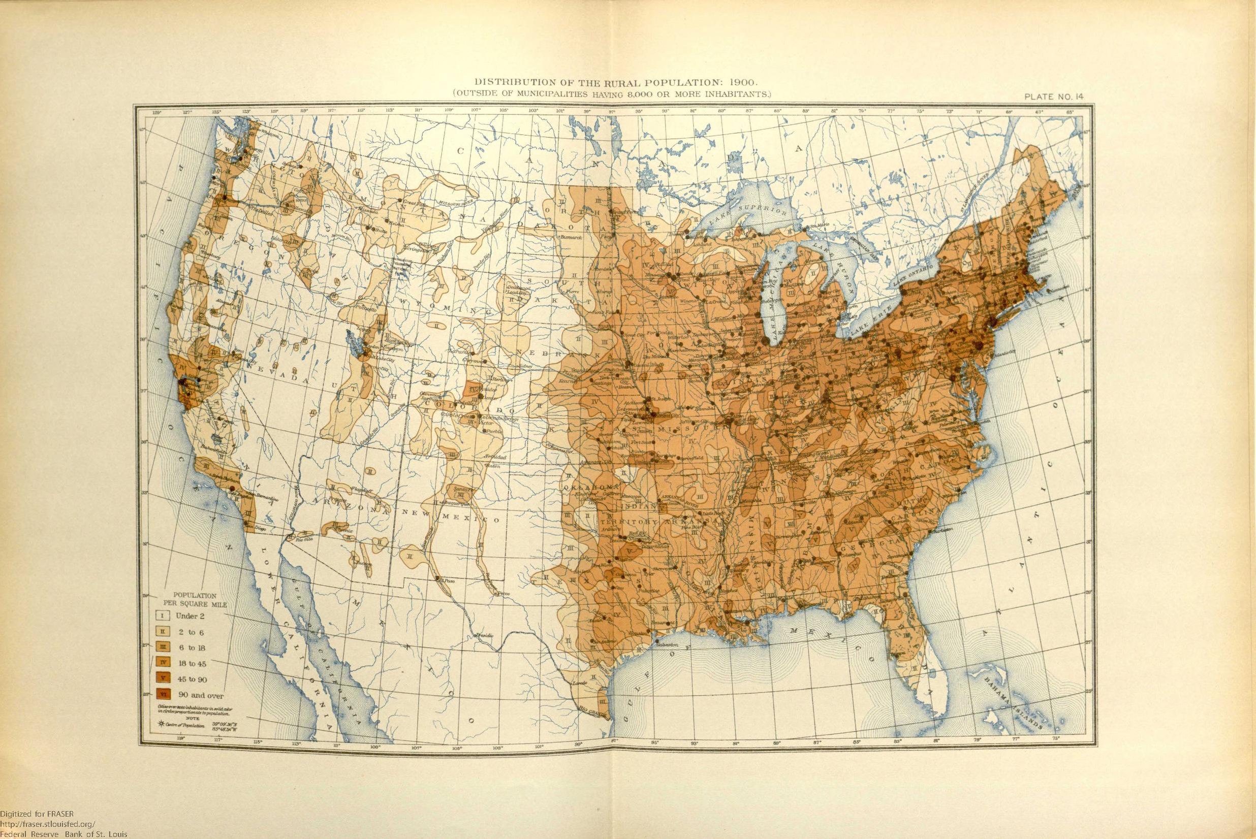
English: This map shows the population distribution of the 45 states and 4 territories of the mainland United States and the extent of the frontier line by 1900. |
| Dátum | |
| Forrás | United States. Bureau of the Census. Statistical Atlas of the United States, 1910 , 1914, https://fraser.stlouisfed.org/title/74, accessed on January 7, 2020. |
| Szerző | Népszámlálási Hivatal |
Licenc
This image or file is a work of a United States Census Bureau employee, taken or made as part of that person's official duties. As a work of the U.S. federal government, the image is in the public domain.
|
 |
Fájltörténet
Kattints egy időpontra, hogy a fájl akkori állapotát láthasd.
| Dátum/idő | Bélyegkép | Felbontás | Feltöltő | Megjegyzés | |
|---|---|---|---|---|---|
| aktuális | 2020. január 7., 22:18 |  | 2 472 × 1 652 (61,4 MB) | Killroy is here | User created page with UploadWizard |
Fájlhasználat
Az alábbi lap használja ezt a fájlt:
Globális fájlhasználat
A következő wikik használják ezt a fájlt:
- Használata itt: en.wikipedia.org