
Fájl:Historical and current boundaries of Lancashire.png
Az előnézet mérete: 411 × 600 képpont További felbontások: 164 × 240 képpont | 329 × 480 képpont | 847 × 1 236 képpont.
Eredeti fájl (847 × 1 236 képpont, fájlméret: 191 KB, MIME-típus: image/png)
|
Ez a fájl a Wikimedia Commonsból származik. Az alább látható leírás az ottani dokumentációjának másolata. A Commons projekt szabad licencű kép- és multimédiatár. Segíts te is az építésében! |
Összefoglaló
| Leírás |
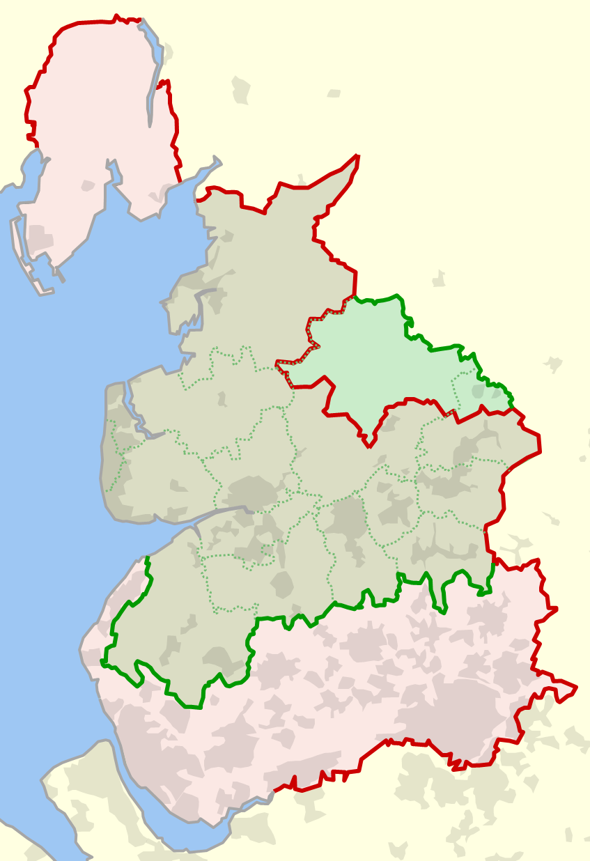
English: The historical boundary of the county of Lancashire, England, shown in red, and the modern-day boundary (since 1974), shown in green. Also shown in dotted green are the modern-day local government districts and unitary authorities of ceremonial Lancashire. |
| Dátum | |
| Forrás | A feltöltő saját munkája |
| Szerző | Dr Greg |
References
- (1929) Combined index shewing civil parishes and the Ordnance Survey of Lancashire archivált másolat at the Wayback Machine, Ordnance Survey, accessed 2010-06-12
- MARIO: Maps & Related Information Online, Lancashire County Council website, accessed 2010-06-12
- OS OpenData, Ordnance Survey website, accessed 2010-06-12
Licenc
| Én, a szerző, ezt a művemet ezennel közkinccsé nyilvánítom. Ez a világ minden részén érvényes. Egyes országokban ez jogilag nem lehetséges. Ha így van, akkor: Jogot adok bárkinek, hogy bármilyen célból, feltétel nélkül használhassa ezt a fájlt, kivéve a törvény által kötelezően előírt feltételeket. |
Fájltörténet
Kattints egy időpontra, hogy a fájl akkori állapotát láthasd.
| Dátum/idő | Bélyegkép | Felbontás | Feltöltő | Megjegyzés | |
|---|---|---|---|---|---|
| aktuális | 2010. június 13., 00:14 | | 847 × 1 236 (191 KB) | Dr Greg | {{Information |Description={{en|1=The historical boundary of the county of en:Lancashire, England, shown in red, and the modern-day boundary (since 1974), shown in green. Also shown in dotted green are the modern-day local government districts and u |
Fájlhasználat
Az alábbi lap használja ezt a fájlt:
Globális fájlhasználat
A következő wikik használják ezt a fájlt:
- Használata itt: ca.wikipedia.org
- Használata itt: en.wikipedia.org
- Használata itt: fr.wikipedia.org
- Használata itt: lt.wikipedia.org
- Használata itt: pt.wikipedia.org