
Fájl:Moers-fuda-stromkarte1.jpg
Az előnézet mérete: 799 × 599 képpont További felbontások: 320 × 240 képpont | 640 × 480 képpont | 1 024 × 768 képpont | 1 280 × 960 képpont | 2 560 × 1 920 képpont | 2 774 × 2 081 képpont.
Eredeti fájl (2 774 × 2 081 képpont, fájlméret: 1,23 MB, MIME-típus: image/jpeg)
|
Ez a fájl a Wikimedia Commonsból származik. Az alább látható leírás az ottani dokumentációjának másolata. A Commons projekt szabad licencű kép- és multimédiatár. Segíts te is az építésében! |
Összefoglaló
| Leírás |
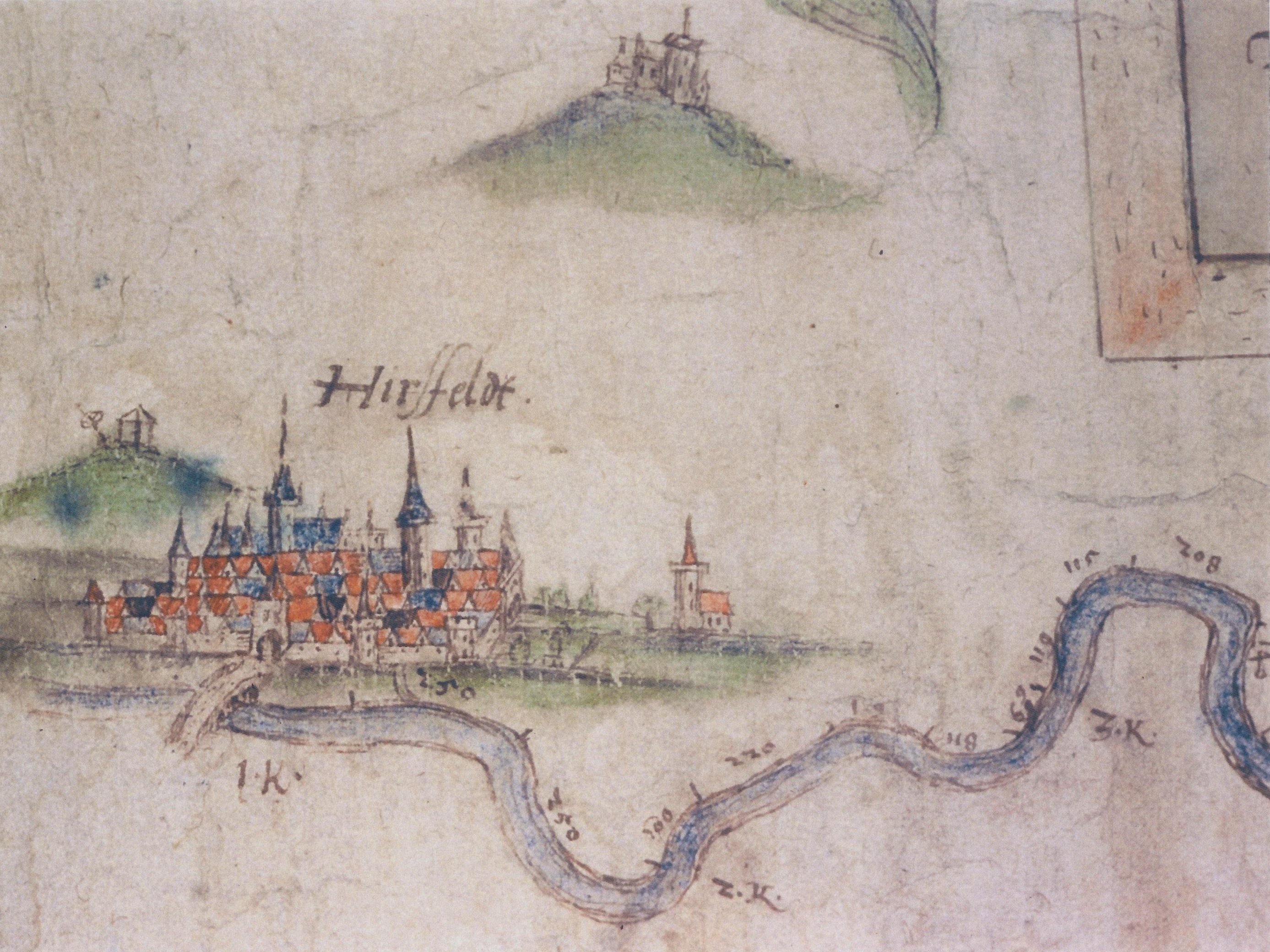
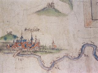
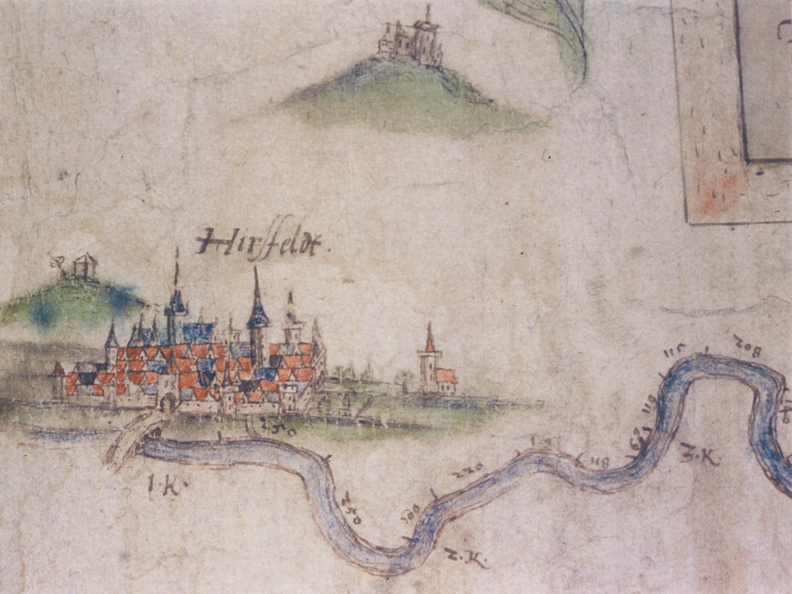
Deutsch: Erster Abschnitt aus der historischen Karte Fulda-Stromkarte von Joist Moers um 1597 angefertigt. Zu sehen ist Hersfeld mit der alten Fuldabrücke und des angedeuteten Zuflusses des Geisbaches im Vordergrund. Rechts daneben ist die auf freiem Feld, in der Fuldaaue, stehende Klauskirche eingezeichnet. Links über der Stadt ist der Galgenplatz mit Galgen und dem Richtrad angedeutet (lag auf einer Anhöhe des Tageberges, heute vermutlich in der Straße "Am Hainberg"). Rechts über der Stadt ist der Frauenberg mit dem dort befindlichen Koster angedeutet. English: First part of the historic map Fulda-Stromkarte from Joist Moers, drawn around 1597. Is's shows the town Hersfeld (today Bad Hersfeld), the old bridge over the river Fulda the church Klauskirche outside of the defensive wall from Hersfeld, the Breaking wheel and gallows, the hill Frauenberg with its monastery. |
||||
| Dátum | |||||
| Forrás | scaned | ||||
| Szerző | Joist Moers (ca. 1540–1625) | ||||
| Engedély (Fájl újrafelhasználása) |
|
||||
Licenc
|
Ez a mű közkincs abban az országban, ahol elkészítették, és minden olyan további államban, ahol a szerzői jogi védelmi idő a szerző élete plusz 100 év vagy kevesebb. | |
| Megállapították, hogy ez a fájl mentes mindenféle szerzői jogi korlátozástól, beleértve az összes kapcsolódó és hozzátartozó jogot. | |
Fájltörténet
Kattints egy időpontra, hogy a fájl akkori állapotát láthasd.
| Dátum/idő | Bélyegkép | Felbontás | Feltöltő | Megjegyzés | |
|---|---|---|---|---|---|
| aktuális | 2010. július 5., 21:48 | | 2 774 × 2 081 (1,23 MB) | 2micha | {{Information |Description={{de|Erster Abschnitt aus der historischen Karte ''Fulda-Stromkarte'' von Joist Moers um 1597 angefertigt. Zu sehen ist Hersfeld mit der alten Fuldabrücke und des angedeuteten Zuflusses des Geisbaches im Vordergrund. Rechts dan |
Fájlhasználat
Az alábbi lap használja ezt a fájlt:
Globális fájlhasználat
A következő wikik használják ezt a fájlt:
- Használata itt: de.wikipedia.org