
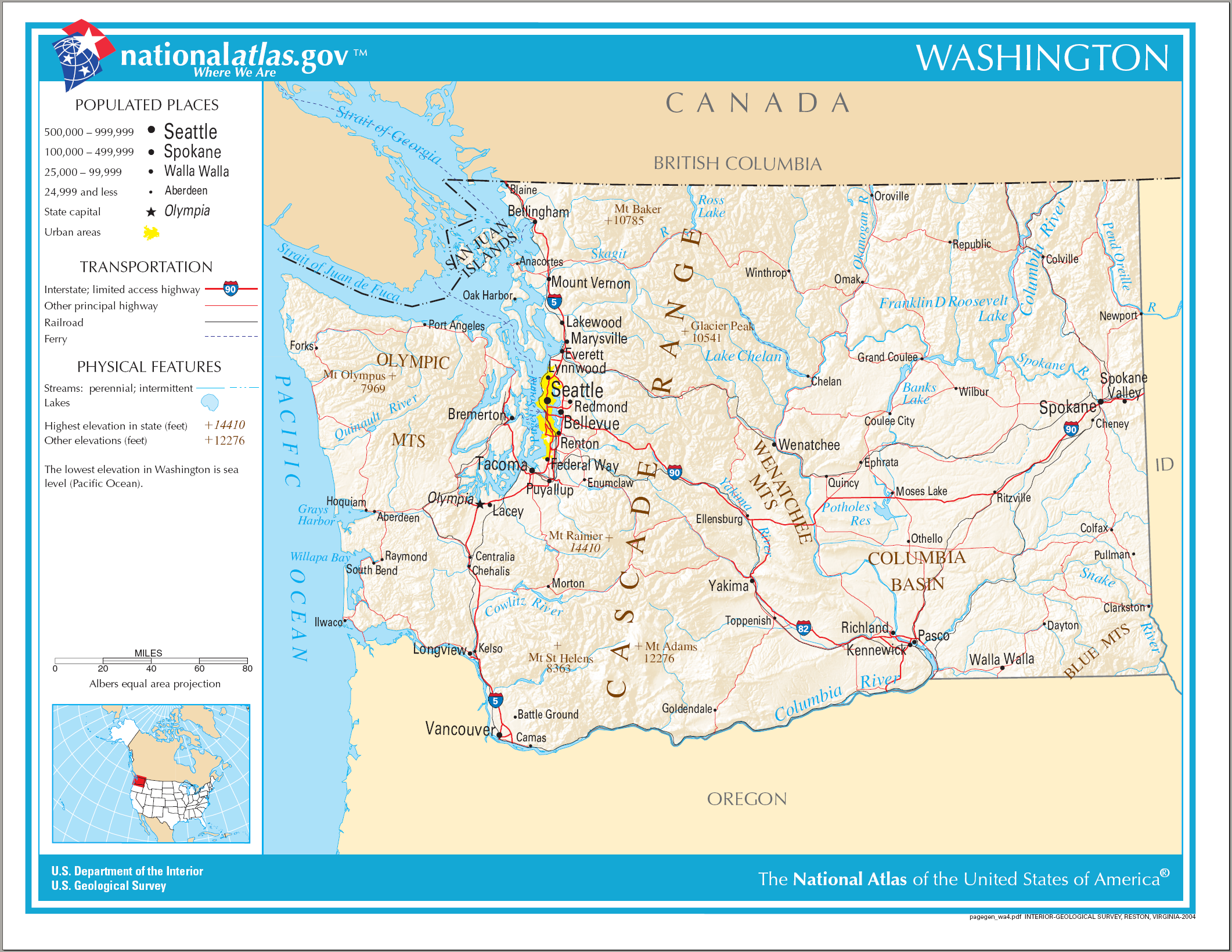
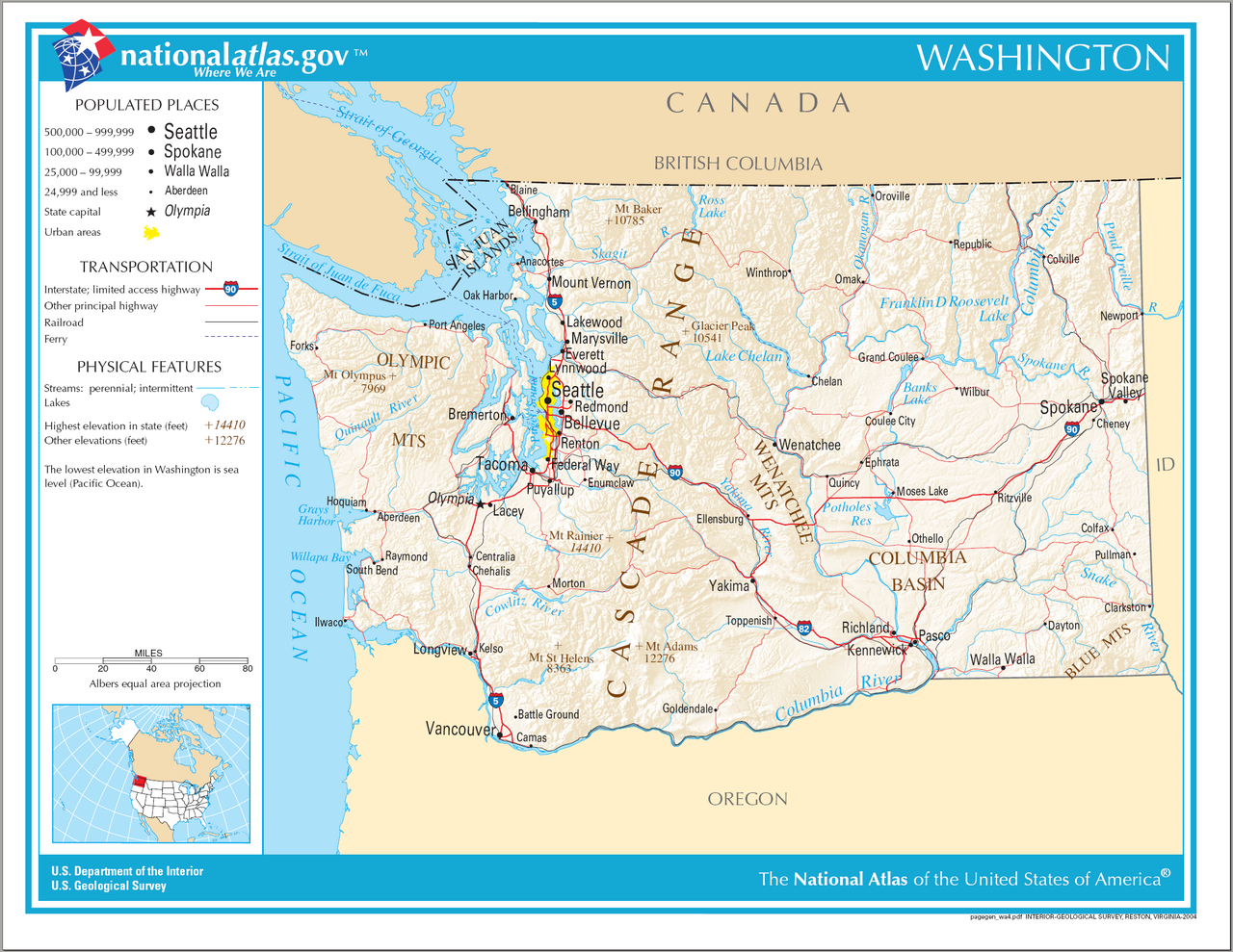
Fájl:Map of Washington NA.png
Az előnézet mérete: 776 × 600 képpont További felbontások: 311 × 240 képpont | 621 × 480 képpont | 994 × 768 képpont | 1 280 × 989 képpont | 2 122 × 1 640 képpont.
Eredeti fájl (2 122 × 1 640 képpont, fájlméret: 2,39 MB, MIME-típus: image/png)
|
Ez a fájl a Wikimedia Commonsból származik. Az alább látható leírás az ottani dokumentációjának másolata. A Commons projekt szabad licencű kép- és multimédiatár. Segíts te is az építésében! |
Összefoglaló
| Leírás | Map of Washington (state). |
| Dátum | |
| Forrás | National Atlas |
| Szerző |
Licenc
This map was obtained from an edition of the National Atlas of the United States. Like almost all works of the U.S. federal government, works from the National Atlas are in the public domain in the United States.
Online access: NationalAtlas.gov | 1970 print edition: Library of Congress, Perry-Castañeda Library
|
Fájltörténet
Kattints egy időpontra, hogy a fájl akkori állapotát láthasd.
| Dátum/idő | Bélyegkép | Felbontás | Feltöltő | Megjegyzés | |
|---|---|---|---|---|---|
| aktuális | 2006. augusztus 15., 12:14 | | 2 122 × 1 640 (2,39 MB) | Huebi~commonswiki | {{Information| |Description=Map of Washington |Source=[http://www.nationalatlas.gov National Atlas] }} Category:Maps of the United States Category:Maps of Washington {{PD-USGov-Atlas}} |
Fájlhasználat
Az alábbi lap használja ezt a fájlt:
Globális fájlhasználat
A következő wikik használják ezt a fájlt:
- Használata itt: ca.wikipedia.org
- Használata itt: de.wikipedia.org
- Használata itt: en.wikipedia.org
- Használata itt: es.wikipedia.org
- Használata itt: hsb.wikipedia.org
- Használata itt: ilo.wikipedia.org
- Használata itt: incubator.wikimedia.org
- Használata itt: is.wikipedia.org
- Használata itt: it.wikipedia.org
- Használata itt: kn.wikipedia.org
- Használata itt: mr.wikipedia.org
- Használata itt: ru.wikivoyage.org
- Használata itt: simple.wikipedia.org
- Használata itt: si.wikipedia.org
- Használata itt: uz.wikipedia.org
- Használata itt: zea.wikipedia.org