
Fájl:Ethiopia climate map.jpg

Az előnézet mérete: 650 × 599 képpont További felbontások: 260 × 240 képpont | 521 × 480 képpont | 833 × 768 képpont | 1 037 × 956 képpont.
Eredeti fájl (1 037 × 956 képpont, fájlméret: 270 KB, MIME-típus: image/jpeg)
|
Ez a fájl a Wikimedia Commonsból származik. Az alább látható leírás az ottani dokumentációjának másolata. A Commons projekt szabad licencű kép- és multimédiatár. Segíts te is az építésében! |
Összefoglaló
| Leírás |
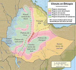
Français : Carte zones climatiques en Éthiopie.
English: Map of climates in Ethiopia |
| Dátum | 2010, based on 1999 map. |
| Forrás | Ethiopia shaded relief map 1999, CIA.jpg |
| Szerző |
CIA |
Licenc
| This image is a work of a Central Intelligence Agency employee, taken or made as part of that person's official duties. As a Work of the United States Government, this image or media is in the public domain in the United States.
|

|
This work is based on a work in the public domain. It has been digitally enhanced and/or modified. This derivative work has been (or is hereby) released into the public domain by its author, Zheim. This applies worldwide.
In some countries this may not be legally possible; if so: |
Eredeti feltöltési napló
This image is a derivative work of the following images:
- File:Ethiopia shaded relief map 1999, CIA.jpg licensed with PD-USGov-CIA
- 2006-02-22T11:23:03Z Lupo 1010x1215 (227536 Bytes) Shaded relief map of [[Ethiopia]]. Source: [http://www.lib.utexas.edu/maps/africa/ethiopia_rel99.jpg] from the [http://www.lib.utexas.edu/maps/ethiopia.html Perry-Castañeda Library Map Collection]. {{PD-USGov-CIA}} [[Cate
Uploaded with derivativeFX
Fájltörténet
Kattints egy időpontra, hogy a fájl akkori állapotát láthasd.
| Dátum/idő | Bélyegkép | Felbontás | Feltöltő | Megjegyzés | |
|---|---|---|---|---|---|
| aktuális | 2010. február 6., 18:05 | | 1 037 × 956 (270 KB) | Zheim~commonswiki | {{en}} add scale {{fr}} rajout de l'échelle |
| 2010. február 6., 01:39 |  | 1 038 × 955 (262 KB) | Zheim~commonswiki | {{Information |Description={{fr}} Carte zones climatiques en Éthiopie {{en}} Map of climates in Ethiopia |Source=*File:_Ethiopia_Map.jpg |Date=2010-02-05 23:38 (UTC) |Author=*File:_Ethiopia_Map.jpg: CIA *derivative work: ~~~ |Permission=see b |
Fájlhasználat
Az alábbi lap használja ezt a fájlt:
Globális fájlhasználat
A következő wikik használják ezt a fájlt:
- Használata itt: de.wikivoyage.org
- Használata itt: en.wikibooks.org
- Használata itt: fr.wikipedia.org
- Használata itt: pt.wikipedia.org
- Használata itt: uk.wikipedia.org