
Fájl:Kammmolchmaennchen.jpg
Az előnézet mérete: 800 × 512 képpont További felbontások: 320 × 205 képpont | 640 × 410 képpont | 1 024 × 655 képpont | 1 517 × 971 képpont.
Eredeti fájl (1 517 × 971 képpont, fájlméret: 1,15 MB, MIME-típus: image/jpeg)
|
Ez a fájl a Wikimedia Commonsból származik. Az alább látható leírás az ottani dokumentációjának másolata. A Commons projekt szabad licencű kép- és multimédiatár. Segíts te is az építésében! |
Összefoglaló
| Leírás |
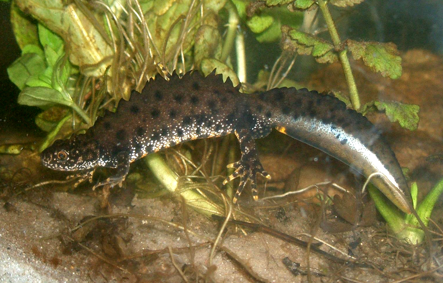
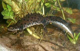
English: The Crested Newt (Triturus cristatus); male specimen in "mating dress" under water.
Deutsch: Der Kammmolch (Triturus cristatus); hier ein Männchen in Wassertracht in einem Aquarium. |
| Dátum | |
| Forrás | originally uploaded on de.wikipedia.org (file: [1]). |
| Szerző | Rainer Theuer. |
![[1]](https://de.wikipedia.org/wiki/Bild:Kammolchmaennchen.JPG)
Licenc
| Én, a szerző, ezt a művemet ezennel közkinccsé nyilvánítom. Ez a világ minden részén érvényes. Egyes országokban ez jogilag nem lehetséges. Ha így van, akkor: Jogot adok bárkinek, hogy bármilyen célból, feltétel nélkül használhassa ezt a fájlt, kivéve a törvény által kötelezően előírt feltételeket. |
Fájltörténet
Kattints egy időpontra, hogy a fájl akkori állapotát láthasd.
| Dátum/idő | Bélyegkép | Felbontás | Feltöltő | Megjegyzés | |
|---|---|---|---|---|---|
| aktuális | 2008. augusztus 23., 18:29 | | 1 517 × 971 (1,15 MB) | Fice | {{Information| |Description='''''English''''': The '''Crested Newt''' (''Triturus cristatus''); male specimen in "mating dress" under water. '''''Deutsch''''': Der '''Kammmolch''' (''Triturus cristatus''); hier ein Männ |
Fájlhasználat
Az alábbi lapok használják ezt a fájlt:
Globális fájlhasználat
A következő wikik használják ezt a fájlt:
- Használata itt: an.wikipedia.org
- Használata itt: arz.wikipedia.org
- Használata itt: az.wikipedia.org
- Használata itt: ba.wikipedia.org
- Használata itt: be.wikipedia.org
- Használata itt: bg.wikipedia.org
- Használata itt: br.wikipedia.org
- Használata itt: ca.wikipedia.org
- Használata itt: ceb.wikipedia.org
- Használata itt: cs.wikipedia.org
- Használata itt: cy.wikipedia.org
- Használata itt: de.wikipedia.org
- Bundesautobahn 44
- Nördlicher Kammmolch
- Schwanzlurche
- Nemphe
- Fließwiese Ruhleben
- Untere Argen und Seitentäler
- Rotachtal Bodensee
- Bodenseehinterland zwischen Salem und Markdorf
- Bodensee Hinterland bei Überlingen
- Feuchtgebiete um Bad Schussenried
- Feuchtgebiete um Altshausen
- Wurzacher Ried und Rohrsee
- Riede und Gewässer bei Mengen und Pfullendorf
- Gebiete um das Laucherttal
- Naturschutzgebiet Unteres Morsbachtal mit Hölterfelder Siefen und Fürberger Bachtal
- Neckar und Seitentäler bei Rottenburg
- Umlachtal und Riß südlich Biberach
- Wälder bei Biberach
- Donau zwischen Munderkingen und Ulm und nördliche Iller
- Donau zwischen Munderkingen und Riedlingen
- Donaumoos (FFH-Gebiet)
- Großer Heuberg und Donautal
- Kuppenalb bei Laichingen und Lonetal
- Schönbuch (FFH-Gebiet)
- Argen und Feuchtgebiete bei Neukirch und Langnau
- Albtrauf zwischen Mössingen und Gönningen
- Baar, Eschach und Südostschwarzwald
- Südliche Baaralb
A fájl globális használatának megtekintése