
Fájl:FrancoPrussianWar5to6Aug1870.jpg
Eredeti fájl (1 083 × 928 képpont, fájlméret: 1,15 MB, MIME-típus: image/jpeg)
|
Ez a fájl a Wikimedia Commonsból származik. Az alább látható leírás az ottani dokumentációjának másolata. A Commons projekt szabad licencű kép- és multimédiatár. Segíts te is az építésében! |
Összefoglaló
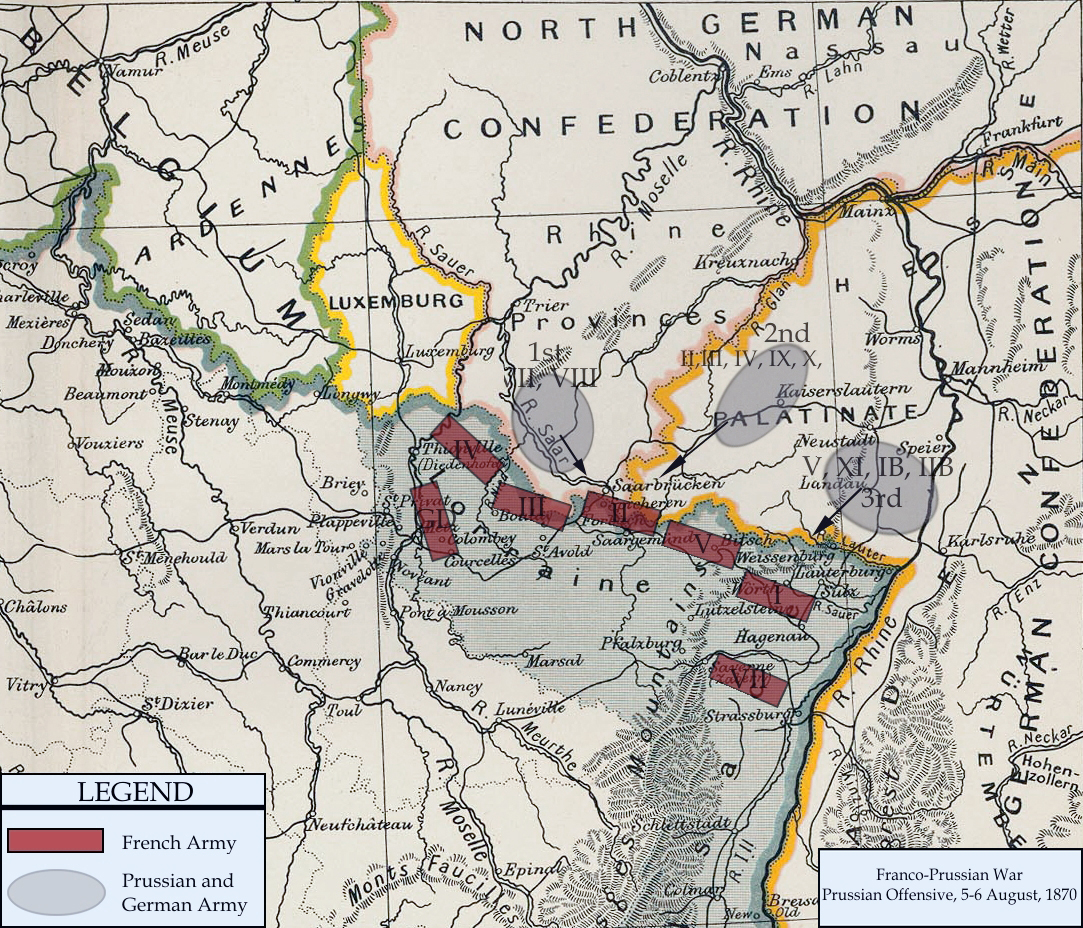
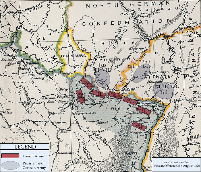
| Leírás | Franco-Prussian War map of 1870 | |||||
| Dátum | ||||||
| Forrás | Cambridge Modern History Atlas | |||||
| Szerző | Edited by A.W.Ward, G.W.Prothero, and Stanley Leathes | |||||
| Engedély (Fájl újrafelhasználása) |
|

I adapted the map to reflect the state of French and Prussian/German armies from 5 to 6 August, 1870. Information for the armies was obtained from Wawro, Geoffrey (2003) The Franco-Prussian War: The German Conquest of France in 1870-1871, Cambridge University Press ISBN: 0-521-58436-1.
Fájltörténet
Kattints egy időpontra, hogy a fájl akkori állapotát láthasd.
| Dátum/idő | Bélyegkép | Felbontás | Feltöltő | Megjegyzés | |
|---|---|---|---|---|---|
| aktuális | 2011. február 15., 22:13 | | 1 083 × 928 (1,15 MB) | DIREKTOR | Repairs |
| 2008. január 3., 22:57 |  | 1 083 × 928 (1,04 MB) | Monsieurdl | == Summary == {{Information |Description=Franco-Prussian War map of 1870 |Source=Cambridge Modern History Atlas |Date=1912 |Author=Edited by A.W.Ward, G.W.Prothero, and Stanley Leathes }} I adapted the map to reflect the state of French and Prussian/Germ |
Fájlhasználat
Az alábbi lap használja ezt a fájlt:
Globális fájlhasználat
A következő wikik használják ezt a fájlt:
- Használata itt: azb.wikipedia.org
- Használata itt: bg.wikipedia.org
- Használata itt: ca.wikipedia.org
- Használata itt: en.wikipedia.org
- Használata itt: hy.wikipedia.org
- Használata itt: ja.wikipedia.org
- Használata itt: tr.wikipedia.org
- Használata itt: vi.wikipedia.org