
Fájl:NPS american-samoa-context-map.jpg
Nem érhető el nagyobb felbontású változat.
NPS_american-samoa-context-map.jpg (471 × 471 képpont, fájlméret: 40 KB, MIME-típus: image/jpeg)
|
Ez a fájl a Wikimedia Commonsból származik. Az alább látható leírás az ottani dokumentációjának másolata. A Commons projekt szabad licencű kép- és multimédiatár. Segíts te is az építésében! |

|
Ezt a képet el kellene készíteni vektorgrafika használatával SVG fájlként. A formátumnak számos előnye van; lásd a Commons:Media for cleanup lapot a további információkért. Ha a képnek már elérhető SVG-formátumú változata, töltsd fel. Az SVG feltöltése után cseréld le ezt a sablont a következőre: {{vector version available|új kép neve.svg}}.
|


Összefoglaló
| Leírás |
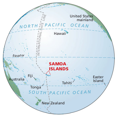
English: Pacific ocean map showing where American Samoa is in relation to the Equator, Fiji, Tahiti, Tonga, Hawaii, and the U.S. mainland – way out there in the Pacific Ocean. |
| Dátum | |
| Forrás | U.S. National Park Service (http://npmaps.com/wp-content/uploads/american-samoa-context-map.jpg) |
| Szerző | U.S. National Park Service, restoration/cleanup by Matt Holly |
Licenc
| This image or media file contains material based on a work of a National Park Service employee, created as part of that person's official duties. As a work of the U.S. federal government, such work is in the public domain in the United States. See the NPS website and NPS copyright policy for more information. |
Fájltörténet
Kattints egy időpontra, hogy a fájl akkori állapotát láthasd.
| Dátum/idő | Bélyegkép | Felbontás | Feltöltő | Megjegyzés | |
|---|---|---|---|---|---|
| aktuális | 2017. május 13., 20:35 | | 471 × 471 (40 KB) | RKBot | =={{int:filedesc}}== {{Information |description= {{en|1=Pacific ocean map showing where American Samoa is in relation to the Equator, Fiji, Tahiti, Tonga, Hawaii, and the U.S. mainland – way out there in the Pacific Ocean.}} |date= 2016-02-22 |source... |
Fájlhasználat
Ezt a fájlt nem használja egyetlen lap sem.
Globális fájlhasználat
A következő wikik használják ezt a fájlt:
- Használata itt: en.wikipedia.org