
Fájl:Kyrgyzstan (6052094329).jpg

Eredeti fájl (1 743 × 900 képpont, fájlméret: 1,77 MB, MIME-típus: image/jpeg)
|
Ez a fájl a Wikimedia Commonsból származik. Az alább látható leírás az ottani dokumentációjának másolata. A Commons projekt szabad licencű kép- és multimédiatár. Segíts te is az építésében! |
.jpg)
Összefoglaló
| Leírás |
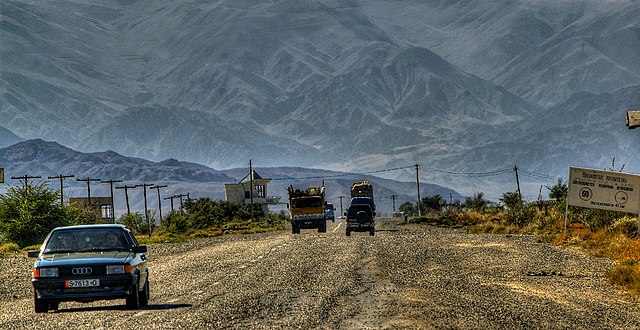
Highway A363 Bishkek towards Balykchy, lake Issyk-Kul and Chinese border (Xinjiang) Hochgebirge trennen den Norden und den Süden Kirgisistans. Die Verkehrsverbindungen sind grundsätzlich mangelhaft, abgesehen von der Gegend um Bischkek. Eine ganzjährig benutzbare Straßenverbindung von Bischkek in den Süden besteht erst seit 2003. In den Gebieten Osch, Batken und Dschalalabat sind die Hauptdurchgangsstraßen durch häufige Grenzübergänge durch usbekisches und tadschikisches Gebiet behindert, da der Straßenbau während der Sowjetzeit ohne Berücksichtigung administrativer Grenzen ausgeführt wurde. Es gibt zwei Straßenverbindungen nach China – den Torugart-Pass und die Route über Irkeschtam –, die aber im Winter häufig durch schwere Schneefälle und Lawinen blockiert sind.(Wikipedia) English: With support from the Asian Development Bank, a major road linking the north and southwest from Bishkek to Osh has recently been completed. This considerably eases communication between the two major population centres of the country—the Chuy Valley in the north and the Fergana Valley in the South. An offshoot of this road branches off across a 3,500 meter pass into the Talas Valley in the northwest. Plans are now being formulated to build a major road from Osh into China. (Wikipedia) |
| Dátum | 2007. szeptember 15., 11:31 (az Exif-információ szerint) |
| Forrás | Kyrgyzstan |
| Szerző | Thomas Depenbusch (Depi) from Cologne, Germany |
| Fényképező elhelyezkedése | | További képek erről a helyről: OpenStreetMap |
|---|
.jpg¶ms=042.704350_N_0075.853155_E_globe:Earth_type:camera_source:Flickr_&language=hu)
Licenc
- A következőket teheted a művel:
- megoszthatod – szabadon másolhatod, terjesztheted, bemutathatod és előadhatod a művet
- feldolgozhatod – származékos műveket hozhatsz létre
- Az alábbi feltételekkel:
- Nevezd meg! – A szerzőt megfelelően fel kell tüntetned, hivatkozást kell létrehoznod a licencre és jelezned kell, ha a művön változtatást hajtottál végre. Ezt bármilyen észszerű módon megteheted, kivéve oly módon, ami azt sugallná hogy a jogosult támogat téged vagy a felhasználásod körülményeit.
| This image was originally posted to Flickr by Thomas Depenbusch (Depi) at https://flickr.com/photos/8324633@N03/6052094329 (archive). It was reviewed on 2018. június 26. by FlickreviewR 2 and was confirmed to be licensed under the terms of the cc-by-2.0. |
Fájltörténet
Kattints egy időpontra, hogy a fájl akkori állapotát láthasd.
| Dátum/idő | Bélyegkép | Felbontás | Feltöltő | Megjegyzés | |
|---|---|---|---|---|---|
| aktuális | 2018. június 26., 04:38 | | 1 743 × 900 (1,77 MB) | Hiàn (alt) | Transferred from Flickr via #flickr2commons |
Fájlhasználat
Ezt a fájlt nem használja egyetlen lap sem.
Globális fájlhasználat
A következő wikik használják ezt a fájlt:
- Használata itt: en.wikipedia.org
.jpg)