
Fájl:Geo Map of Median Income by Location in Maryland.png
Az előnézet mérete: 800 × 584 képpont További felbontások: 320 × 234 képpont | 640 × 467 képpont | 1 024 × 748 képpont | 1 208 × 882 képpont.
Eredeti fájl (1 208 × 882 képpont, fájlméret: 521 KB, MIME-típus: image/png)
|
Ez a fájl a Wikimedia Commonsból származik. Az alább látható leírás az ottani dokumentációjának másolata. A Commons projekt szabad licencű kép- és multimédiatár. Segíts te is az építésében! |
Összefoglaló
| Leírás |
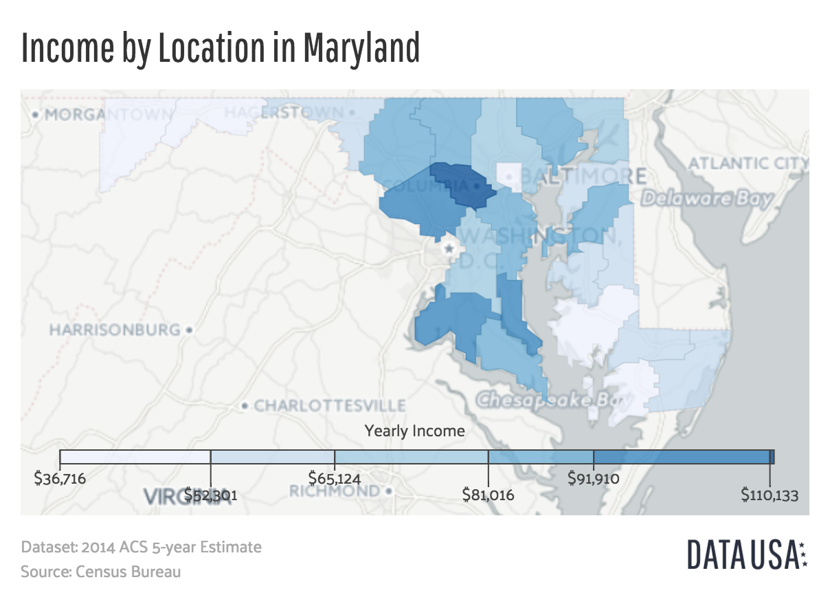
English: A map showing Maryland's median income by county. Data is sourced from the 2014 ACS 5-year Estimate report published by the US Census Bureau. |
||
| Dátum | |||
| Forrás | http://datausa.io/profile/geo/maryland/#income_geo | ||
| Szerző | Datawheel, LLC | ||
| Más változatok |
|

Licenc

|
This work is free software; you can redistribute it and/or modify it under the terms of the GNU Affero General Public License as published by the Free Software Foundation; either version 3 of the License, or any later version. This work is distributed in the hope that it will be useful, but without any warranty; without even the implied warranty of merchantability or fitness for a particular purpose. See version 3 of the GNU Affero General Public License for more details.
|
Fájltörténet
Kattints egy időpontra, hogy a fájl akkori állapotát láthasd.
| Dátum/idő | Bélyegkép | Felbontás | Feltöltő | Megjegyzés | |
|---|---|---|---|---|---|
| aktuális | 2016. augusztus 3., 22:48 | | 1 208 × 882 (521 KB) | Mattrdini | User created page with UploadWizard |
Fájlhasználat
Ezt a fájlt nem használja egyetlen lap sem.
Globális fájlhasználat
A következő wikik használják ezt a fájlt:
- Használata itt: en.wikipedia.org
- Használata itt: tr.wikipedia.org