
Fájl:Geo Map of Income by Location in Texas (2014).png
Az előnézet mérete: 545 × 599 képpont További felbontások: 218 × 240 képpont | 436 × 480 képpont | 802 × 882 képpont.
Eredeti fájl (802 × 882 képpont, fájlméret: 246 KB, MIME-típus: image/png)
|
Ez a fájl a Wikimedia Commonsból származik. Az alább látható leírás az ottani dokumentációjának másolata. A Commons projekt szabad licencű kép- és multimédiatár. Segíts te is az építésében! |
.png)
Összefoglaló
| Leírás |
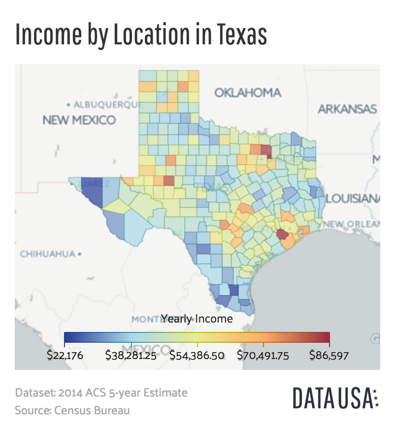
English: A map of the median income of each county in Texas as of 2014. |
| Dátum | |
| Forrás | http://datausa.io/profile/geo/texas/#income_geo |
| Szerző | Datawheel, LLC |
Licenc

|
This work is free software; you can redistribute it and/or modify it under the terms of the GNU Affero General Public License as published by the Free Software Foundation; either version 3 of the License, or any later version. This work is distributed in the hope that it will be useful, but without any warranty; without even the implied warranty of merchantability or fitness for a particular purpose. See version 3 of the GNU Affero General Public License for more details.
|
Fájltörténet
Kattints egy időpontra, hogy a fájl akkori állapotát láthasd.
| Dátum/idő | Bélyegkép | Felbontás | Feltöltő | Megjegyzés | |
|---|---|---|---|---|---|
| aktuális | 2016. június 8., 17:25 | | 802 × 882 (246 KB) | Mattrdini | User created page with UploadWizard |
Fájlhasználat
Ezt a fájlt nem használja egyetlen lap sem.
Globális fájlhasználat
A következő wikik használják ezt a fájlt:
- Használata itt: de.wikipedia.org
- Használata itt: en.wikipedia.org
.png)