
Fájl:Map of OIC.png

Az előnézet mérete: 800 × 400 képpont További felbontások: 320 × 160 képpont | 640 × 320 képpont | 1 250 × 625 képpont.
Eredeti fájl (1 250 × 625 képpont, fájlméret: 40 KB, MIME-típus: image/png)
|
Ez a fájl a Wikimedia Commonsból származik. Az alább látható leírás az ottani dokumentációjának másolata. A Commons projekt szabad licencű kép- és multimédiatár. Segíts te is az építésében! |
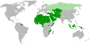
| Leírás | Members of OIC |
| Dátum | |
| Forrás | A feltöltő saját munkája |
| Szerző | Myrzic Cyril |
| Ez a kép közkincs, mert nincs egyéni-eredeti jellege. |
Fájltörténet
Kattints egy időpontra, hogy a fájl akkori állapotát láthasd.
| Dátum/idő | Bélyegkép | Felbontás | Feltöltő | Megjegyzés | |
|---|---|---|---|---|---|
| aktuális | 2018. február 2., 22:31 | | 1 250 × 625 (40 KB) | Maphobbyist | Check |
| 2018. február 2., 22:26 |  | 1 250 × 625 (40 KB) | Maphobbyist | Added borders of South Sudan which became idependent in 2011 and which is not a member of the OIC. | |
| 2008. augusztus 27., 15:31 |  | 1 250 × 625 (55 KB) | Myrzich Cyril | {{Information |Description= |Source= |Date= |Author= |Permission= |other_versions= }} | |
| 2008. május 26., 14:53 |  | 1 250 × 625 (55 KB) | Myrzich Cyril | {{Information |Description= Members of OIC |Source= Собственная работа |Date= may 26, 2008 |Author= Myrzich Cyril |Permission= |other_versions= }} {{PD-ineligible}} Category:Subcontinental maps | |
| 2008. május 26., 14:31 |  | 1 250 × 625 (55 KB) | Myrzich Cyril | {{Information |Description= Members of OIC |Source= Собственная работа |Date= may 26, 2008 |Author= Myrzic Cyril |Permission= |other_versions= }} {{PD-ineligible}} Category:Subcontinental maps |
Fájlhasználat
Ezt a fájlt nem használja egyetlen lap sem.
Globális fájlhasználat
A következő wikik használják ezt a fájlt:
- Használata itt: be.wikipedia.org
- Használata itt: en.wikipedia.org
- Használata itt: es.wikipedia.org
- Használata itt: fa.wikipedia.org
- Használata itt: fr.wikipedia.org
- Használata itt: he.wikipedia.org
- Használata itt: it.wikipedia.org
- Használata itt: uk.wikipedia.org