
Fájl:Macau locator map.svg

Ennek a(z) SVG fájlnak ezen PNG formátumú előnézete: 705 × 599 képpont. További felbontások: 282 × 240 képpont | 565 × 480 képpont | 904 × 768 képpont | 1 205 × 1 024 képpont | 2 409 × 2 048 képpont | 1 067 × 907 képpont.
Eredeti fájl (SVG fájl, névlegesen 1 067 × 907 képpont, fájlméret: 313 KB)
|
Ez a fájl a Wikimedia Commonsból származik. Az alább látható leírás az ottani dokumentációjának másolata. A Commons projekt szabad licencű kép- és multimédiatár. Segíts te is az építésében! |
Összefoglaló
| Leírás |
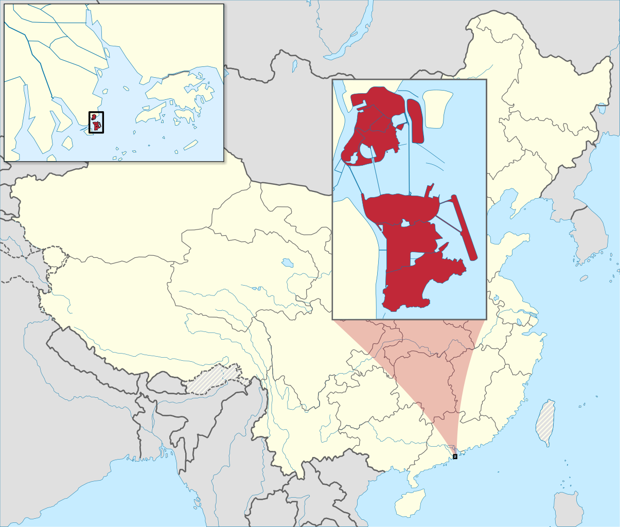
English: Locator map of Macau, China.
Français : Carte de localisation de Macao, Chine. |
| Dátum | (UTC) |
| Forrás | |
| Szerző | |
| Más változatok | |
| Így nevezd meg (a licenc megköveteli) | © Sémhur / Wikimedia Commons / |
| SVG | W3C-validity not checked. Ez vektorgrafikus kép Inkscape segítségével készült . |
| Graphic Lab |
.svg)
| Fényképező elhelyezkedése | | További képek erről a helyről: OpenStreetMap |
|---|
Licenc
Én, e mű szerzője a művemet az alábbi licencek alatt teszem közzé:
| Copyleft: ez a művészeti alkotás szabadon terjeszthető és/vagy módosítható a Free Art License feltételei alapján. E licenc egy példánya a Copyleft Attitude oldalon és számos más weboldalon olvasható. |
This file is licensed under the Creative Commons Attribution-Share Alike 4.0 International, 3.0 Unported, 2.5 Generic, 2.0 Generic and 1.0 Generic license.
- A következőket teheted a művel:
- megoszthatod – szabadon másolhatod, terjesztheted, bemutathatod és előadhatod a művet
- feldolgozhatod – származékos műveket hozhatsz létre
- Az alábbi feltételekkel:
- Nevezd meg! – A szerzőt megfelelően fel kell tüntetned, hivatkozást kell létrehoznod a licencre és jelezned kell, ha a művön változtatást hajtottál végre. Ezt bármilyen észszerű módon megteheted, kivéve oly módon, ami azt sugallná hogy a jogosult támogat téged vagy a felhasználásod körülményeit.
- Így add tovább! – Ha megváltoztatod, átalakítod, feldolgozod ezt a művet, a közreműködésedet csak az eredetivel megegyező vagy hasonló licenc alatt terjesztheted.
A mű a fenti licencek bármelyike szerint felhasználható.
Eredeti feltöltési napló
This image is a derivative work of the following images:
- File:China_Macau.svg licensed with PD-self
- 2008-08-13T16:28:07Z Joowwww 1000x850 (212000 Bytes) added missing laos/vietnam border
- 2008-05-14T11:19:01Z Joowwww 1000x850 (210391 Bytes) {{Information |Description=An SVG map of China with the Macau special administrative region highlighted and circled Legend:[[Image:China map legend.png]] |Source=self-made; based on CIA public domain maps: *http://www.lib.ut
- File:Macau_Location.svg licensed with PD-self
- 2009-05-06T03:17:53Z ASDFGHJ 1270x640 (235764 Bytes) .
- 2009-05-06T03:16:44Z ASDFGHJ 1270x640 (235753 Bytes) still looks small in size
- 2009-05-06T03:10:04Z ASDFGHJ 1270x640 (235799 Bytes) add airport
- 2009-05-06T02:19:30Z ASDFGHJ 1270x640 (235052 Bytes) More closer zoom
- 2009-05-06T02:15:43Z ASDFGHJ 1270x640 (235024 Bytes) Zoom in the map more
- 2009-05-06T01:56:08Z ASDFGHJ 1270x640 (234931 Bytes) {{Information |Description=A map showing Macau's location in Asia, in China and on China's south coast. |Source=[[:file:Hong Kong Location.svg]] by [[User:Joowwww|Joowwww]] |Date=2008-04-09 |Author= [[:en:User:ASDFGH|ASDFGHJ]
- File:People's_Republic_of_China_(orthographic_projection).svg licensed with Cc-by-sa-3.0,2.5,2.0,1.0, GFDL, GFDL-GMT
- 2009-05-13T23:18:42Z Shibo77 541x541 (492315 Bytes) Reverted to version as of 20:43, 16 February 2009
- 2009-05-11T07:14:38Z Jjhcap99 541x541 (510234 Bytes) Reverted to version as of 16:53, 16 February 2009
- 2009-02-16T20:43:19Z Shibo77 541x541 (492315 Bytes) Reverted to version as of 01:23, 14 February 2009
- 2009-02-16T16:53:16Z Uirauna 541x541 (510234 Bytes) Reverted to version as of 17:30, 9 February 2009 to reflect the NPOV rules, claimed territories should not be marked light green in the map
- 2009-02-14T01:23:58Z Shibo77 541x541 (492315 Bytes) ..
- 2009-02-14T01:09:04Z Shibo77 541x541 (488887 Bytes) Reverted to version as of 01:10, 27 October 2008
- 2009-02-09T17:34:05Z Uirauna 541x541 (510234 Bytes) Sorry, I uploaded the wrong file, this is the correct one.
- 2009-02-09T17:30:31Z Uirauna 541x541 (510234 Bytes) According to the [[Wikipedia:Neutral point of view]] rules, I have removed the light green marks over the regions claimed by PRC but controlled by other nationas, such as Taiwan and Arunachal Pradesh. Other country maps ( suc
- 2008-10-27T01:10:00Z Ssolbergj 541x541 (488887 Bytes) {{Information |Description={{en|1=The People's Republic of China (green) and its claimed territory (lighter green).}} |Source=as |Author=~~~ |Date=27 October 2008 |Permission= |other_versions= }} [[Category:Maps of China]]
- File:MapOfMacauMunicipalities.svg licensed with PD-self
- 2009-06-22T22:39:10Z Cdip150 420x640 (38446 Bytes) {{Information |Description={{en|A map showing the municipalities of Macau SAR {{zh-hant|[[:zh:澳門行政區劃|]]地圖}}}} {{Inkscape}} |Source=self |Date=2009-6-23 |Author=[[User:Cdip150]] |Permission= |other_versions= }
Uploaded with derivativeFX
Fájltörténet
Kattints egy időpontra, hogy a fájl akkori állapotát láthasd.
| Dátum/idő | Bélyegkép | Felbontás | Feltöltő | Megjegyzés | |
|---|---|---|---|---|---|
| aktuális | 2022. május 21., 15:40 | | 1 067 × 907 (313 KB) | Crab2814 | Recoloured the mini-map. |
| 2022. május 20., 17:50 |  | 1 067 × 907 (314 KB) | Crab2814 | Updated the map so it looks more the Hong Kong locator map. | |
| 2022. május 18., 12:32 |  | 1 067 × 907 (327 KB) | Crab2814 | Updated the colour scheme. | |
| 2010. január 14., 20:26 |  | 1 000 × 850 (326 KB) | Sémhur | == {{int:filedesc}} == {{Information |Description={{en|1=Locator map of Macau, China.}} {{fr|1=Carte de localisation de Macao, Chine.}} |Source=*File:China_Macau.svg *File:Macau_Location.svg *[[:File:People's_Republ |
Fájlhasználat
Ezt a fájlt nem használja egyetlen lap sem.
Globális fájlhasználat
A következő wikik használják ezt a fájlt:
- Használata itt: alt.wikipedia.org
- Használata itt: ami.wikipedia.org
- Használata itt: am.wikipedia.org
- Használata itt: an.wikipedia.org
- Használata itt: ar.wikipedia.org
- Használata itt: arz.wikipedia.org
- Használata itt: ast.wikipedia.org
- Használata itt: as.wikipedia.org
- Használata itt: av.wikipedia.org
- Használata itt: azb.wikipedia.org
- Használata itt: az.wikipedia.org
- Használata itt: ba.wikipedia.org
- Használata itt: be-tarask.wikipedia.org
- Használata itt: be.wikipedia.org
- Használata itt: bn.wikipedia.org
- Használata itt: bxr.wikipedia.org
- Használata itt: ca.wikipedia.org
- Használata itt: ceb.wikipedia.org
- Használata itt: ce.wikipedia.org
- Használata itt: chr.wikipedia.org
- Használata itt: ckb.wikipedia.org
- Használata itt: crh.wikipedia.org
- Használata itt: cs.wikipedia.org
- Használata itt: da.wikipedia.org
- Használata itt: diq.wikipedia.org
- Használata itt: dty.wikipedia.org
- Használata itt: dz.wikipedia.org
- Használata itt: en.wikipedia.org
- Használata itt: en.wikinews.org
- Használata itt: eo.wikipedia.org
- Használata itt: es.wikipedia.org
- Használata itt: es.wikivoyage.org
- Használata itt: es.wiktionary.org
- Használata itt: fa.wikipedia.org
- Használata itt: fi.wikipedia.org
- Használata itt: fi.wiktionary.org
- Használata itt: fr.wikipedia.org
A fájl globális használatának megtekintése