
Fájl:Eure department location map.svg

Ennek a(z) SVG fájlnak ezen PNG formátumú előnézete: 699 × 600 képpont. További felbontások: 280 × 240 képpont | 559 × 480 képpont | 895 × 768 képpont | 1 193 × 1 024 képpont | 2 386 × 2 048 képpont | 1 165 × 1 000 képpont.
Eredeti fájl (SVG fájl, névlegesen 1 165 × 1 000 képpont, fájlméret: 431 KB)
|
Ez a fájl a Wikimedia Commonsból származik. Az alább látható leírás az ottani dokumentációjának másolata. A Commons projekt szabad licencű kép- és multimédiatár. Segíts te is az építésében! |
Összefoglaló
| Fényképező elhelyezkedése | | További képek erről a helyről: OpenStreetMap |
|---|
| Leírás |
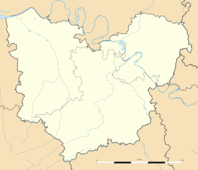
Français : Carte administrative vierge du département de l'Eure, France, destinée à la géolocalisation. Estimated scale: 1:400,000 (precision: 100 m)
Geographic limits of the map:
|
||
| Dátum | |||
| Forrás |
A feltöltő saját munkája
|
||
| Szerző | Eric Gaba (Sting - fr:Sting) | ||
| Engedély (Fájl újrafelhasználása) |
|
||
| Más változatok |
|

Licenc
Eric Gaba, Wikimedia Commons user Sting, e mű szerzője a művét az alábbi licenc alatt teszi közzé:
Ez a fájl a Creative Commons Nevezd meg! – Így add tovább! 3.0 Unported licenc alapján használható fel.
Így nevezd meg: Eric Gaba, Wikimedia Commons user Sting
- A következőket teheted a művel:
- megoszthatod – szabadon másolhatod, terjesztheted, bemutathatod és előadhatod a művet
- feldolgozhatod – származékos műveket hozhatsz létre
- Az alábbi feltételekkel:
- Nevezd meg! – A szerzőt megfelelően fel kell tüntetned, hivatkozást kell létrehoznod a licencre és jelezned kell, ha a művön változtatást hajtottál végre. Ezt bármilyen észszerű módon megteheted, kivéve oly módon, ami azt sugallná hogy a jogosult támogat téged vagy a felhasználásod körülményeit.
- Így add tovább! – Ha megváltoztatod, átalakítod, feldolgozod ezt a művet, a közreműködésedet csak az eredetivel megegyező vagy hasonló licenc alatt terjesztheted.
Fájltörténet
Kattints egy időpontra, hogy a fájl akkori állapotát láthasd.
| Dátum/idő | Bélyegkép | Felbontás | Feltöltő | Megjegyzés | |
|---|---|---|---|---|---|
| aktuális | 2010. március 12., 03:38 | | 1 165 × 1 000 (431 KB) | Sting | == {{int:filedesc}} == {{Location|49|04|30|N|01|03|00|E|scale:500000}} <br/> {{Information |Description={{en|Blank administrative map of the department of Eure, France, for geo-location purpose.}} |
Fájlhasználat
Az alábbi lap használja ezt a fájlt:
Globális fájlhasználat
A következő wikik használják ezt a fájlt:
- Használata itt: als.wikipedia.org
- Használata itt: de.wikipedia.org
- Használata itt: eo.wikipedia.org
- Gisors
- Ŝablono:Situo sur mapo Francio Eure
- Les Andelys
- Bernay (Eure)
- Conches-en-Ouche
- Giverny
- Évreux-Normandie (stacidomo)
- Verneuil-sur-Avre
- Bernay (stacidomo)
- Serquigny (stacidomo)
- Val-de-Reuil (stacidomo)
- Beaumont-le-Roger
- Pont-Audemer
- Verneuil-sur-Avre (stacidomo)
- Brionne (stacidomo)
- Bourgtheroulde-Infreville
- Thuit-Hébert
- Bueil (stacidomo)
- Glos - Montfort (stacidomo)
- Bourgtheroulde - Thuit-Hébert (stacidomo)
- Bourth
- Bourth (stacidomo)
- Nonancourt
- Tillières-sur-Avre
- Saint-Germain-sur-Avre
- Tillières (stacidomo)
- Nonancourt (stacidomo)
- Saint-Germain - Saint-Rémy (stacidomo)
- Acquigny
- Aigleville
- Amfreville-sur-Iton
- Angerville-la-Campagne
- Arnières-sur-Iton
- Aviron (Eure)
- Les Baux-Sainte-Croix
- Boisset-les-Prévanches
- La Boissière (Eure)
- Le Boulay-Morin
- Breuilpont
- Caillouet-Orgeville
- Caugé
- Chaignes
- Chambray
- Louviers
- Boncourt (Eure)
- La Chapelle-du-Bois-des-Faulx
A fájl globális használatának megtekintése