
Fájl:China Gansu adm location map.svg

Eredeti fájl (SVG fájl, névlegesen 998 × 789 képpont, fájlméret: 275 KB)
|
Ez a fájl a Wikimedia Commonsból származik. Az alább látható leírás az ottani dokumentációjának másolata. A Commons projekt szabad licencű kép- és multimédiatár. Segíts te is az építésében! |
Összefoglaló
| Leírás |
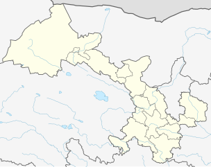
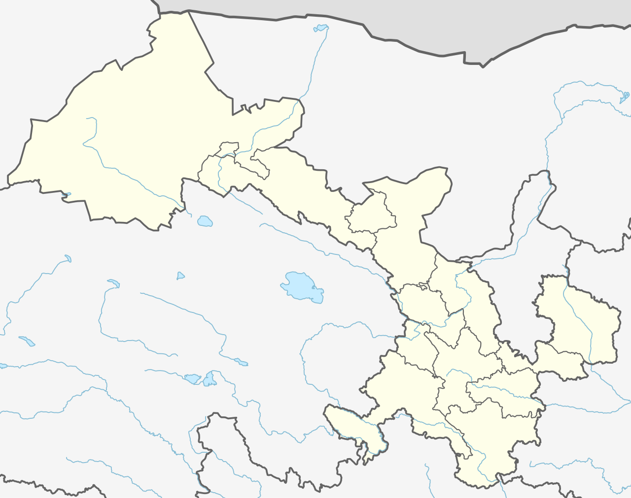
Deutsch: Positionskarte von Gansu, Volksrepublik China
English: Location map of the Gansu, People's Republic of China
|
||||||||||||
| Dátum | |||||||||||||
| Forrás |
Own work using:
|
||||||||||||
| Szerző | NordNordWest | ||||||||||||
| Más változatok |
|
||||||||||||


|
Ezt a térképet a német Kartenwerkstatt készítette vagy javította. Te is javasolhatsz térképeket javításra.
|
Licenc
Usage of this file with:

explanatory notes: Legally binding is only the full legalcode. For a free usage I recommend to respect the following licence conditions:
1. Provide my name as given above: NordNordWest,
2. a copy of, or the URI for, the applicable license: https://creativecommons.org/licenses/by-sa/3.0/de/legalcode,
3. the title of the work,
4. in the case of an adaptation, a credit identifying the use of the work in the adaptation.
This license and the rights granted hereunder will terminate automatically upon any breach by you of the terms of this license. Any of the above conditions can be waived if you get permission from the copyright holder. If you have questions or wish differing conditions, please contact me through nnwest or my discussion page ![]() t-online.de
t-online.de
- A következőket teheted a művel:
- megoszthatod – szabadon másolhatod, terjesztheted, bemutathatod és előadhatod a művet
- feldolgozhatod – származékos műveket hozhatsz létre
- Az alábbi feltételekkel:
- Nevezd meg! – A szerzőt megfelelően fel kell tüntetned, hivatkozást kell létrehoznod a licencre és jelezned kell, ha a művön változtatást hajtottál végre. Ezt bármilyen észszerű módon megteheted, kivéve oly módon, ami azt sugallná hogy a jogosult támogat téged vagy a felhasználásod körülményeit.
- Így add tovább! – Ha megváltoztatod, átalakítod, feldolgozod ezt a művet, a közreműködésedet csak az eredetivel megegyező vagy hasonló licenc alatt terjesztheted.

Fájltörténet
Kattints egy időpontra, hogy a fájl akkori állapotát láthasd.
| Dátum/idő | Bélyegkép | Felbontás | Feltöltő | Megjegyzés | |
|---|---|---|---|---|---|
| aktuális | 2019. december 12., 14:15 | | 998 × 789 (275 KB) | NordNordWest | corr |
| 2019. december 11., 23:02 |  | 974 × 789 (284 KB) | NordNordWest | == {{int:filedesc}} == {{Information |Description= {{de|1=Positionskarte von Gansu, Volksrepublik China}} {{en|1=Location map of the Gansu, People's Republic of China}} {{Location map series N |stretching=126 |top=43 |bottom=32.4 |left=92.5 |right=109 }} |Source={{Own using}} * United States National Imagery and Mapping Agency data * World Data Base II data |Date=2019-12-11 |Author={{U|NordNordWest}} |Permission= |other_versions= }} {{Kartenwerkstatt}} == {{int:license-header}} == {{User:Nor... |
Fájlhasználat
Az alábbi lap használja ezt a fájlt:
Globális fájlhasználat
A következő wikik használják ezt a fájlt:
- Használata itt: bn.wikipedia.org
- Használata itt: de.wikipedia.org
- Használata itt: en.wikipedia.org
- Lanzhou
- Jiuquan
- Tianshui
- Xiahe County
- Jiayuguan City
- Linxia City
- Yongjing County
- Hezuo
- Subei Mongol Autonomous County
- Bairi Tibetan Autonomous County
- Baiyin
- Dingxi
- Jinchang
- Wuwei, Gansu
- Dunhuang Mogao International Airport
- Jiayuguan Jiuquan Airport
- Lanzhou Zhongchuan International Airport
- Yongchang County
- Qingyang Airport
- Xifeng, Qingyang
- Longxi County
- Sunan Yugur Autonomous County
- Zhelaizhai
- Chongxin County
- Liangdang County
- Cheng County
- Linxia County
- Kangle County
- Guanghe County
- Hezheng County
- Dongxiang Autonomous County
- Jishishan Bonan, Dongxiang and Salar Autonomous County
- Hui County
- Zhangjiachuan Hui Autonomous County
- Qinzhou, Tianshui
- Jingtai County
- Huining County
- Jingyuan County, Gansu
- Yongdeng County
- Gaolan County
- Yuzhong County
- Gulang County
- Minqin County
A fájl globális használatának megtekintése