
Fájl:C80195s1 Ant.Map Cape Selborne.jpg
Az előnézet mérete: 714 × 600 képpont További felbontások: 286 × 240 képpont | 572 × 480 képpont | 914 × 768 képpont | 1 219 × 1 024 képpont | 2 438 × 2 048 képpont | 3 848 × 3 232 képpont.
Eredeti fájl (3 848 × 3 232 képpont, fájlméret: 1,44 MB, MIME-típus: image/jpeg)
|
Ez a fájl a Wikimedia Commonsból származik. Az alább látható leírás az ottani dokumentációjának másolata. A Commons projekt szabad licencű kép- és multimédiatár. Segíts te is az építésében! |
| Leírás |
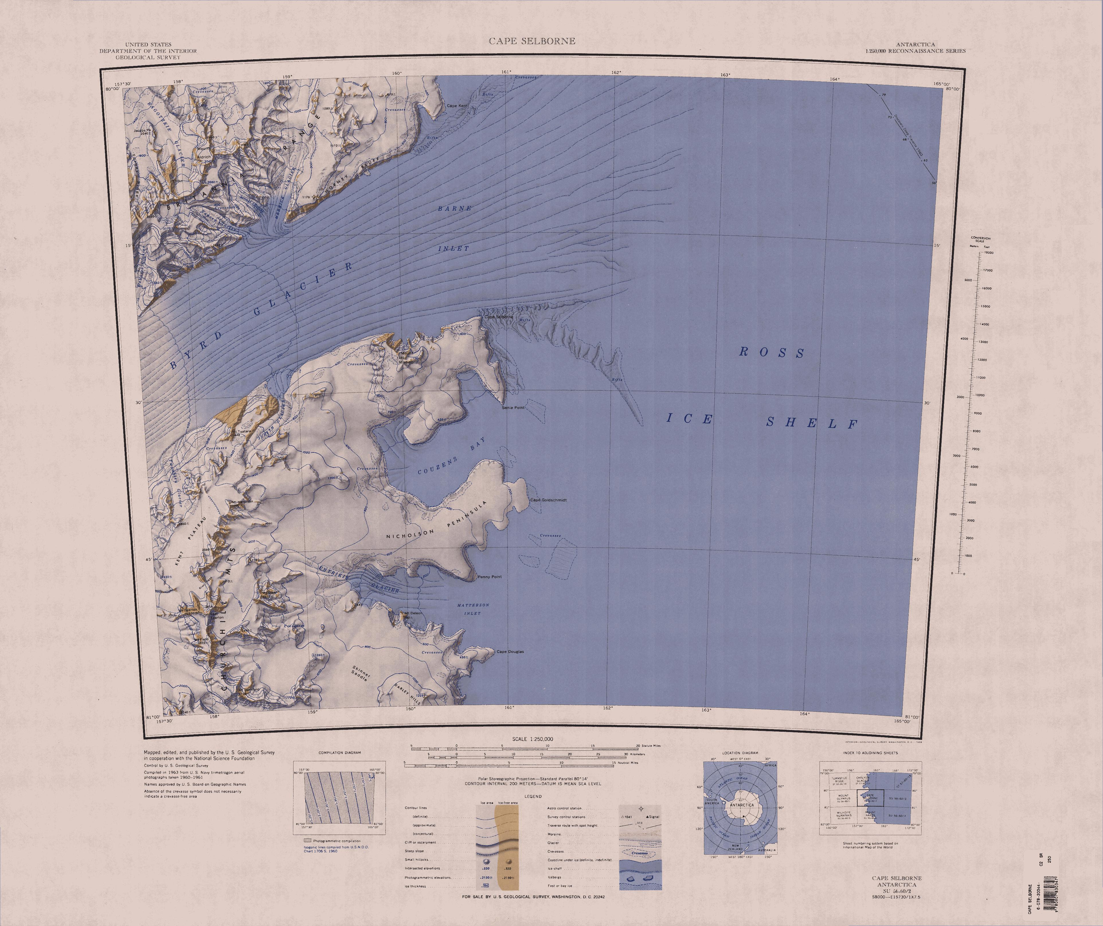
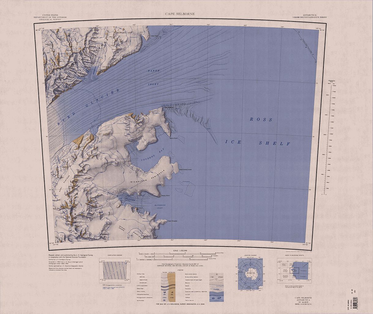
English: Map of Antarctica by the United States Antarctic Resource Center of the US Geological Society. |
| Forrás | USGS |
| Szerző | USGS |
This image is in the public domain in the United States because it only contains materials that originally came from the United States Geological Survey, an agency of the United States Department of the Interior. For more information, see the official USGS copyright policy.
|
Fájltörténet
Kattints egy időpontra, hogy a fájl akkori állapotát láthasd.
| Dátum/idő | Bélyegkép | Felbontás | Feltöltő | Megjegyzés | |
|---|---|---|---|---|---|
| aktuális | 2005. április 3., 21:17 | | 3 848 × 3 232 (1,44 MB) | Achim Raschka | Map of Antarctica by the United States Antarctic Ressource Center of the US Geological Society. {{PD-US}} Copyrights and Trademarks USGS-authored or produced data and information are in the public domain. While the content of most USGS web pages is in th |
Fájlhasználat
Az alábbi lap használja ezt a fájlt:
Globális fájlhasználat
A következő wikik használják ezt a fájlt:
- Használata itt: bg.wikipedia.org
- Használata itt: ceb.wikipedia.org
- Használata itt: de.wikipedia.org
- Byrd-Gletscher
- Churchill Mountains
- Kap Selborne
- Mount Hamilton (Churchill Mountains)
- Kent-Plateau
- Kiwi-Pass
- Penny Point
- Nicholson-Halbinsel
- Senia Point
- Kap Goldschmidt
- Mount Deleon
- Entrikin-Gletscher
- Britannia Range
- Ragotzkie-Gletscher
- Barne Inlet
- Kap Kerr
- Hillary-Küste
- Shackleton-Küste
- Borowski Peak
- Diskussion:Borowski Peak
- Yancey-Gletscher
- Horney Bluff
- Judith-Gletscher
- Mount Madison
- Cornwell Corner
- DeVries-Gletscher
- Mount Dick (Antarktika)
- Jacobs Peak
- Skinner Saddle
- Használata itt: en.wikipedia.org
- Használata itt: es.wikipedia.org
- Használata itt: he.wikipedia.org
- Használata itt: it.wikipedia.org
A fájl globális használatának megtekintése