
Fájl:Battle of Pea Ridge 1.png
Eredeti fájl (2 000 × 1 462 képpont, fájlméret: 2,03 MB, MIME-típus: image/png)
|
Ez a fájl a Wikimedia Commonsból származik. Az alább látható leírás az ottani dokumentációjának másolata. A Commons projekt szabad licencű kép- és multimédiatár. Segíts te is az építésében! |
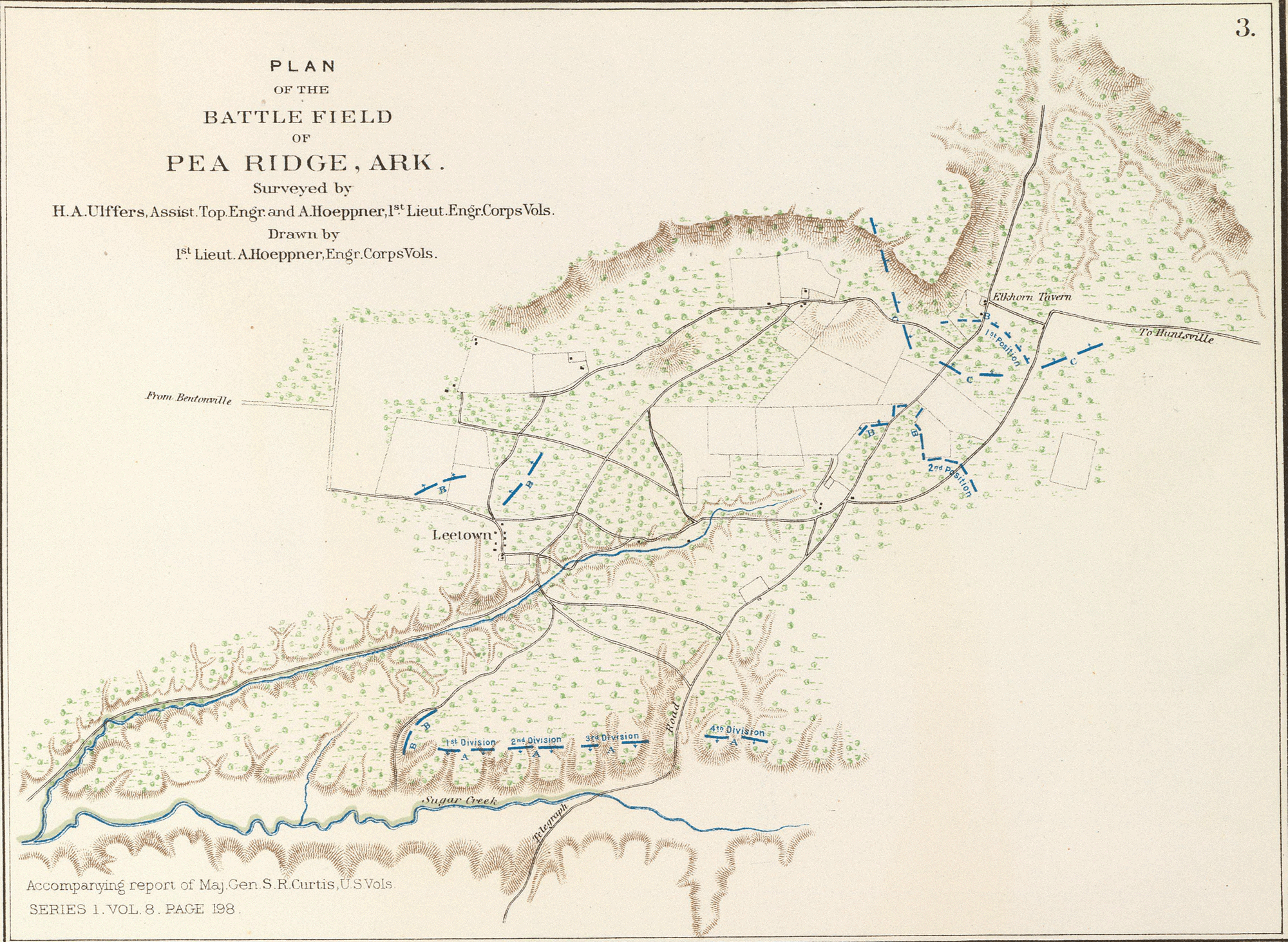
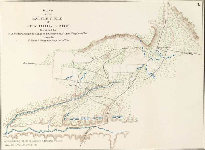
- English: Plan of the battle-field of Pea Ridge, Ark. Surveyed by H.A. Ulffers ... and A. Hoeppner
- Julius Bien & Co., Lith., N.Y. (1891-1895)
- Author: United States. War Department
- Date: 1895
- Higher-resolution version available from the David Rumsey Historical Map Collection
|
Ez a mű közkincs abban az országban, ahol elkészítették, és minden olyan további államban, ahol a szerzői jogi védelmi idő a szerző élete plusz 70 év vagy kevesebb.
| |
| Megállapították, hogy ez a fájl mentes mindenféle szerzői jogi korlátozástól, beleértve az összes kapcsolódó és hozzátartozó jogot. | |
Fájltörténet
Kattints egy időpontra, hogy a fájl akkori állapotát láthasd.
| Dátum/idő | Bélyegkép | Felbontás | Feltöltő | Megjegyzés | |
|---|---|---|---|---|---|
| aktuális | 2005. június 13., 12:22 | | 2 000 × 1 462 (2,03 MB) | ¡0-8-15! | *Map showing the system of rebel fortifications on the Mississippi River at Island No. 10 and New Madrid, also the operations of the U.S. forces under General John Pope against these positions. *Route from Keetsville to Fayetteville, Ark. *Plan of the bat |
Fájlhasználat
Az alábbi lapok használják ezt a fájlt:
Globális fájlhasználat
A következő wikik használják ezt a fájlt:
- Használata itt: en.wikipedia.org
- Használata itt: fr.wikipedia.org
- Használata itt: it.wikipedia.org
- Használata itt: ja.wikipedia.org
- Használata itt: nl.wikipedia.org
- Használata itt: pl.wikipedia.org
- Használata itt: ru.wikipedia.org
- Használata itt: zh.wikipedia.org