
Fájl:Ancient tamilakam ports.png
Eredeti fájl (4 984 × 4 925 képpont, fájlméret: 9 MB, MIME-típus: image/png)
|
Ez a fájl a Wikimedia Commonsból származik. Az alább látható leírás az ottani dokumentációjának másolata. A Commons projekt szabad licencű kép- és multimédiatár. Segíts te is az építésében! |
Összefoglaló
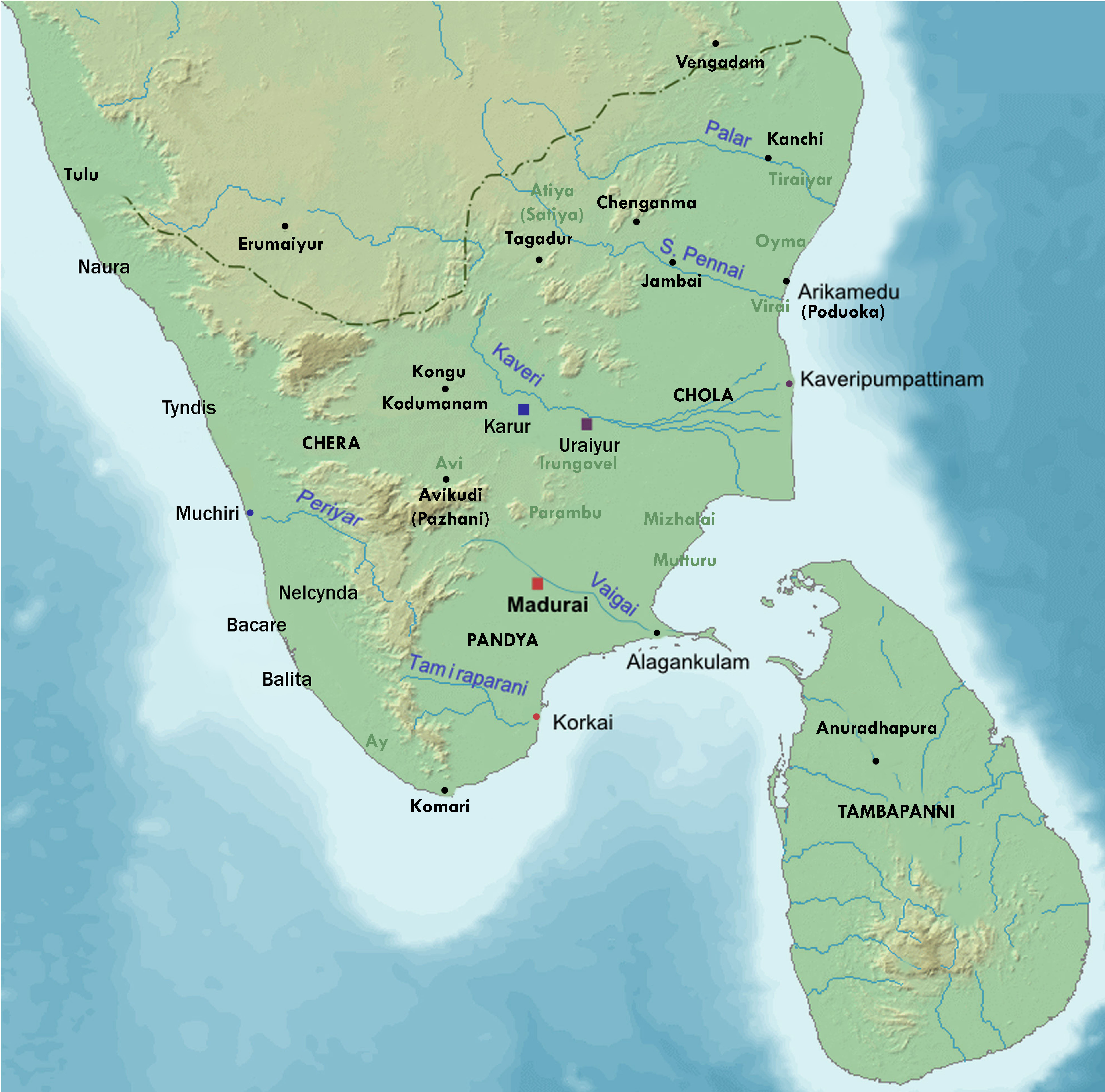
| Leírás | Map showing the important port cities of ancient Tamil country and its approximate northern boundary |
| Dátum | |
| Forrás |
Source of map: http://www2.demis.nl/mapserver/mapper.asp (mention : "Disclaimer: With this statement DEMIS BV grants you permission to freely copy the PNG images returned by our server and use them for your own purposes, including web pages. We would appreciate a reference to our server but such a reference is not required, nor do we take responsibility for the accuracy or quality of the maps". at http://www2.demis.nl/mapserver/DataSrc.htm) Modified by me using Inkscape. |
| Szerző | Lotlil |
Licenc
| I, Lotlil, a mű szerzője művét közkinccsé nyilvánította. Ez a világ minden részén érvényes. Egyes országokban ez jogilag nem lehetséges. Ha így van, akkor: I, Lotlil jogot ad bárkinek, hogy bármilyen célból, feltétel nélkül használhassa ezt a fájlt, kivéve a törvény által kötelezően előírt feltételeket. |
Fájltörténet
Kattints egy időpontra, hogy a fájl akkori állapotát láthasd.
| Dátum/idő | Bélyegkép | Felbontás | Feltöltő | Megjegyzés | |
|---|---|---|---|---|---|
| aktuális | 2019. november 29., 09:24 | | 4 984 × 4 925 (9 MB) | StephenPaa | Added more locations |
| 2019. augusztus 29., 11:41 |  | 2 000 × 2 000 (2,61 MB) | StephenPaa | Added Karur | |
| 2019. augusztus 29., 10:57 |  | 2 000 × 2 000 (2,61 MB) | StephenPaa | Corrected the colour of some ports and the Chera country | |
| 2007. augusztus 7., 06:49 |  | 800 × 800 (385 KB) | Lotlil | {{Information |Description=Map showing the important port cities of ancient Tamil country and its approximate northern boundary |Source=Source of map: http://www2.demis.nl/mapserver/mapper.asp (mention : "Disclaimer: With this statement DEMIS BV grants yo | |
| 2007. augusztus 7., 06:41 |  | 800 × 800 (385 KB) | Lotlil | {{Information |Description=Map showing the important port cities of ancient Tamil country and its approximate northern boundary |Source=Source of map: http://www2.demis.nl/mapserver/mapper.asp (mention : "Disclaimer: With this statement DEMIS BV grants yo |
Fájlhasználat
Az alábbi lap használja ezt a fájlt:
Globális fájlhasználat
A következő wikik használják ezt a fájlt:
- Használata itt: ar.wikipedia.org
- Használata itt: de.wikipedia.org
- Használata itt: en.wikipedia.org
- Használata itt: ko.wikipedia.org