
Fájl:Tierra del Fuego location map.svg

Eredeti fájl (SVG fájl, névlegesen 1 535 × 1 550 képpont, fájlméret: 824 KB)
|
Ez a fájl a Wikimedia Commonsból származik. Az alább látható leírás az ottani dokumentációjának másolata. A Commons projekt szabad licencű kép- és multimédiatár. Segíts te is az építésében! |
Összefoglaló
| Leírás |
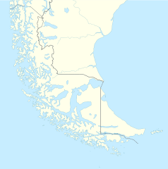
Deutsch: Positionskarte von Feuerland und Umgebung
Quadratische Plattkarte, N-S-Streckung 160 %. Geographische Begrenzung der Karte:
English: Location map of Tierra del Fuego and surroundings
Equirectangular projection, N/S stretching 160 %. Geographic limits of the map:
Español: Ubicación de Tierra del Fuego y alrededores
Proyección equirectangular, N/S 160% de estiramiento. Límites geográficos del mapa:
|
|
| Dátum | ||
| Forrás |
A feltöltő saját munkája, using
|
|
| Szerző | NordNordWest | |
| Engedély (Fájl újrafelhasználása) |
Ez a fájl a Creative Commons Nevezd meg! – Így add tovább! 3.0 Németország licenc alatt lett közzétéve.
 Ez a fájl a Creative Commons Nevezd meg! – Így add tovább! 3.0 Németország licenc alatt lett közzétéve.
|
|
| Más változatok |
Származékos művek: |

.svg)

|
Ezt a térképet a német Kartenwerkstatt készítette vagy javította. Te is javasolhatsz térképeket javításra.
|
Fájltörténet
Kattints egy időpontra, hogy a fájl akkori állapotát láthasd.
| Dátum/idő | Bélyegkép | Felbontás | Feltöltő | Megjegyzés | |
|---|---|---|---|---|---|
| aktuális | 2024. március 5., 18:20 | | 1 535 × 1 550 (824 KB) | Janitoalevic | More specific Beagle Channel |
| 2022. december 29., 03:23 |  | 1 535 × 1 550 (588 KB) | Janitoalevic | Improved borders | |
| 2020. május 3., 21:41 |  | 1 535 × 1 550 (566 KB) | Janitoalevic | Improved Isla de los Estados | |
| 2020. május 3., 20:47 |  | 1 535 × 1 550 (558 KB) | Janitoalevic | Improved | |
| 2017. augusztus 30., 01:23 |  | 1 535 × 1 550 (441 KB) | Janitoalevic | Fixed size | |
| 2017. augusztus 29., 13:23 |  | 1 535 × 1 550 (510 KB) | NordNordWest | Reverted to version as of 20:59, 15 March 2016 (UTC); change of size is catastrophic to some templates | |
| 2017. augusztus 29., 00:18 |  | 1 638 × 1 653 (442 KB) | Janitoalevic | More precise borders and lakes | |
| 2016. március 15., 22:59 |  | 1 535 × 1 550 (510 KB) | Janitoalevic | Fixed limits following Google Earth/maps limits | |
| 2016. március 3., 00:12 |  | 1 535 × 1 550 (510 KB) | Janitoalevic | Updated | |
| 2015. szeptember 11., 22:34 |  | 1 535 × 1 550 (508 KB) | Janitoalevic | Added Southern Patagonian Ice Field (Campo de hielo Patagónico Sur) undefined limits part, since 1998 For more information read: https://en.wikipedia.org/wiki/Southern_Patagonian_Ice_Field#Borderline Now with full resolution. |
Fájlhasználat
Az alábbi lapok használják ezt a fájlt:
Globális fájlhasználat
A következő wikik használják ezt a fájlt:
- Használata itt: als.wikipedia.org
- Használata itt: ar.wikipedia.org
- Használata itt: az.wikipedia.org
- Használata itt: ba.wikipedia.org
- Használata itt: bn.wikipedia.org
- Használata itt: ceb.wikipedia.org
- Használata itt: cs.wikipedia.org
- Használata itt: da.wikipedia.org
- Használata itt: de.wikipedia.org
- Használata itt: el.wikipedia.org
- Használata itt: en.wikipedia.org
- Tierra del Fuego
- Ushuaia – Malvinas Argentinas International Airport
- Isla Grande de Tierra del Fuego
- Puerto Williams
- Río Grande, Tierra del Fuego
- Diego Ramírez Islands
- Riesco Island
- Hoste Island
- Viedma (volcano)
- Cerro Torre
- Fitz Roy
- Viedma Lake
- Gallegos River
- Mount Darwin (Andes)
- Puerto Toro
- Dawson Island
- Ildefonso Islands
- Hermite Islands
- Southern Patagonian Ice Field
- Navarino Island
- Cordillera Darwin
- Cordillera Sarmiento
- Londonderry Island
- Hornos Island
- Grey Lake
- Desolación Island
- Clarence Island, Chile
- Gordon Island
- Juan Guillermos Island
A fájl globális használatának megtekintése