
Fájl:Map of Kentucky highlighting Letcher County.svg

Ennek a(z) SVG fájlnak ezen PNG formátumú előnézete: 800 × 345 képpont. További felbontások: 320 × 138 képpont | 640 × 276 képpont | 1 024 × 441 képpont | 1 280 × 551 képpont | 2 560 × 1 103 képpont | 6 770 × 2 916 képpont.
Eredeti fájl (SVG fájl, névlegesen 6 770 × 2 916 képpont, fájlméret: 127 KB)
|
Ez a fájl a Wikimedia Commonsból származik. Az alább látható leírás az ottani dokumentációjának másolata. A Commons projekt szabad licencű kép- és multimédiatár. Segíts te is az építésében! |
Összefoglaló
| Leírás |
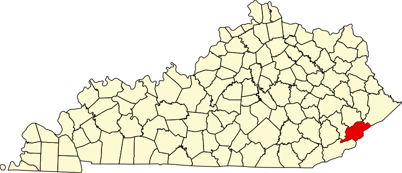
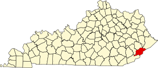
English: This is a locator map showing Letcher County in Kentucky. For more information, see Commons:United States county locator maps. |
| Dátum | |
| Forrás |
A feltöltő saját munkája: English: The maps use data from nationalatlas.gov, specifically countyp020.tar.gz on the Raw Data Download page. The maps also use state outline data from statesp020.tar.gz. The Florida maps use hydrogm020.tar.gz to display Lake Okeechobee. |
| Szerző | David Benbennick |
Licenc
| Én, a szerző, ezt a művemet ezennel közkinccsé nyilvánítom. Ez a világ minden részén érvényes. Egyes országokban ez jogilag nem lehetséges. Ha így van, akkor: Jogot adok bárkinek, hogy bármilyen célból, feltétel nélkül használhassa ezt a fájlt, kivéve a törvény által kötelezően előírt feltételeket. |
Fájltörténet
Kattints egy időpontra, hogy a fájl akkori állapotát láthasd.
| Dátum/idő | Bélyegkép | Felbontás | Feltöltő | Megjegyzés | |
|---|---|---|---|---|---|
| aktuális | 2006. február 12., 14:23 | | 6 770 × 2 916 (127 KB) | David Benbennick | {{subst:User:Dbenbenn/clm|county=Letcher County|state=Kentucky}} |
Fájlhasználat
Az alábbi lapok használják ezt a fájlt:
Globális fájlhasználat
A következő wikik használják ezt a fájlt:
- Használata itt: ar.wikipedia.org
- Használata itt: bg.wikipedia.org
- Használata itt: bpy.wikipedia.org
- Használata itt: cdo.wikipedia.org
- Használata itt: ceb.wikipedia.org
- Használata itt: ce.wikipedia.org
- Használata itt: cy.wikipedia.org
- Használata itt: de.wikipedia.org
- Használata itt: en.wikipedia.org
- Letcher County, Kentucky
- Blackey, Kentucky
- Fleming-Neon, Kentucky
- Jenkins, Kentucky
- McRoberts, Kentucky
- Whitesburg, Kentucky
- North Fork Kentucky River
- Seco, Kentucky
- List of counties in Kentucky
- Isom, Kentucky
- Eastern Kentucky Coalfield
- Template:Letcher County, Kentucky
- User:Nyttend/County templates/KY/2
- Letcher, Kentucky
- Ermine, Kentucky
- David A. Zegeer Coal-Railroad Museum
- National Register of Historic Places listings in Letcher County, Kentucky
- Category:Populated places in Letcher County, Kentucky
- Carbon Glow, Kentucky
- Gaskill, Kentucky
- Little Colly, Kentucky
- Uz, Kentucky
- Kingdom Come, Kentucky
- Hot Spot, Kentucky
- Ice, Kentucky
- Red Star, Kentucky
- Hubert, Kentucky
- Indian Bottom, Kentucky
- Neon, Letcher County, Kentucky
- Tillie, Kentucky
- Ulvah, Kentucky
A fájl globális használatának megtekintése