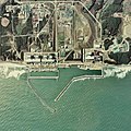
Fájl:Fukushima I NPP 1975.jpg

Az előnézet mérete: 600 × 600 képpont További felbontások: 240 × 240 képpont | 480 × 480 képpont | 768 × 768 képpont | 1 024 × 1 024 képpont | 2 511 × 2 511 képpont.
Eredeti fájl (2 511 × 2 511 képpont, fájlméret: 1,15 MB, MIME-típus: image/jpeg)
Fájltörténet
Kattints egy időpontra, hogy a fájl akkori állapotát láthasd.
| Dátum/idő | Bélyegkép | Felbontás | Feltöltő | Megjegyzés | |
|---|---|---|---|---|---|
| aktuális | 2017. október 24., 10:43 |  | 2 511 × 2 511 (1,15 MB) | Togabi | Color adjustment. |
| 2011. április 4., 14:26 |  | 2 511 × 2 511 (1,17 MB) | 84user | Reverted to version as of 09:18, 15 January 2011 please make a new image page for such a change | |
| 2011. április 2., 23:32 |  | 2 511 × 2 496 (1,18 MB) | Hydrargyrum | lossless rotation 90 deg. left to place north at top (standard) and match Google Maps and other online mapping sites. | |
| 2011. január 15., 11:18 |  | 2 511 × 2 511 (1,17 MB) | Qurren | == {{int:filedesc}} == {{Information |Description={{en|1=en:Fukushima I Nuclear Power Plant.}} {{ja|1=ja:福島第一原子力発電所。}} |Source=Japan Ministry of Land, Infrastructure and Transport. [http://w3land.mlit.go.jp/cgi-bin/WebGIS |
Fájlhasználat
Az alábbi lap használja ezt a fájlt:
Globális fájlhasználat
A következő wikik használják ezt a fájlt:
- Használata itt: af.wikipedia.org
- Használata itt: ar.wikipedia.org
- Használata itt: ast.wikipedia.org
- Használata itt: be-tarask.wikipedia.org
- Használata itt: ca.wikipedia.org
- Használata itt: ca.wikinews.org
- Használata itt: cs.wikipedia.org
- Használata itt: cv.wikipedia.org
- Használata itt: da.wikipedia.org
- Használata itt: de.wikipedia.org
- Használata itt: en.wikipedia.org
- Használata itt: en.wikinews.org
- Használata itt: eo.wikipedia.org
- Használata itt: es.wikipedia.org
- Használata itt: et.wikipedia.org
- Használata itt: fa.wikipedia.org
- Használata itt: fr.wikipedia.org
- Használata itt: fr.wikinews.org
- Que s'est-il passé dans la centrale nucléaire de Fukushima Daiichi ?
- Accidents nucléaires de Fukushima : les évènements du 18 mars 2011
- Accidents nucléaires de Fukushima : les évènements du 22 mars 2011
- Accidents nucléaires de Fukushima : les évènements du 28 mars 2011
- Accidents nucléaires de Fukushima : des employés essayent de boucher la fuite d'eau radioactive
- Accidents nucléaires de Fukushima : la fuite d'eau radioactive colmatée
- Használata itt: he.wikipedia.org
- Használata itt: hif.wikipedia.org
- Használata itt: hr.wikipedia.org
- Használata itt: id.wikipedia.org
- Használata itt: it.wikipedia.org
- Használata itt: ja.wikipedia.org
- Használata itt: jv.wikipedia.org
- Használata itt: ml.wikipedia.org
- Használata itt: mr.wikipedia.org
- Használata itt: ms.wikipedia.org
- Használata itt: nl.wikipedia.org
- Használata itt: pl.wikipedia.org
- Használata itt: ro.wikipedia.org
A fájl globális használatának megtekintése


