
Fájl:USACE Kentucky Lock and Dam.jpg

Az előnézet mérete: 800 × 534 képpont További felbontások: 320 × 214 képpont | 640 × 427 képpont | 1 024 × 683 képpont | 1 500 × 1 001 képpont.
Eredeti fájl (1 500 × 1 001 képpont, fájlméret: 510 KB, MIME-típus: image/jpeg)
|
Ez a fájl a Wikimedia Commonsból származik. Az alább látható leírás az ottani dokumentációjának másolata. A Commons projekt szabad licencű kép- és multimédiatár. Segíts te is az építésében! |
| Leírás |
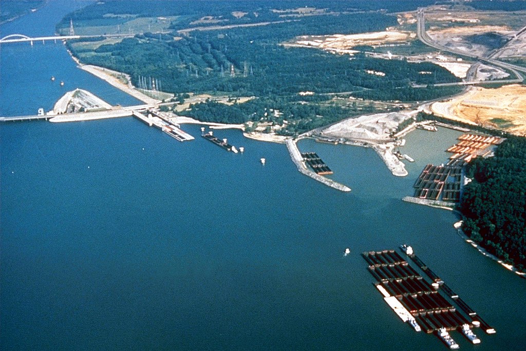
English: Kentucky Lock and Dam at the lower end of Kentucky Lake near Grand Rivers, Kentucky, USA. The lock and dam impound the 184-mile (296 km) Kentucky Lake and provide flood control, river navigation, hydroelectric power production, and recreation. The lock is operated and maintained by the U.S. Army Corps of Engineers. |
|||
| Dátum | not specified or unknown | |||
| Forrás |
U.S. Army Corps of Engineers Digital Visual Library Image page Image description page Digital Visual Library home page |
|||
| Szerző | George Green, U.S. Army Corps of Engineers | |||
| Engedély (Fájl újrafelhasználása) |
|
| Fényképező elhelyezkedése | | További képek erről a helyről: OpenStreetMap |
|---|
Fájltörténet
Kattints egy időpontra, hogy a fájl akkori állapotát láthasd.
| Dátum/idő | Bélyegkép | Felbontás | Feltöltő | Megjegyzés | |
|---|---|---|---|---|---|
| aktuális | 2007. március 27., 05:39 | | 1 500 × 1 001 (510 KB) | DanMS | {{Information | Description = {{en|Kentucky Lock and Dam at the lower end of Kentucky Lake near Grand Rivers, Kentucky, USA. The lock and dam impound the 184-mile (296 km) Kentucky Lake and provide flood control, river navigation, hydroelectric power |
Fájlhasználat
Az alábbi lap használja ezt a fájlt:
Globális fájlhasználat
A következő wikik használják ezt a fájlt:
- Használata itt: en.wikipedia.org
- Használata itt: ja.wikipedia.org