
Fájl:Stillwater Minnesota waterfront aerial view.jpg

Az előnézet mérete: 749 × 600 képpont További felbontások: 300 × 240 képpont | 600 × 480 képpont | 959 × 768 képpont | 1 279 × 1 024 képpont | 1 500 × 1 201 képpont.
Eredeti fájl (1 500 × 1 201 képpont, fájlméret: 1,05 MB, MIME-típus: image/jpeg)
|
Ez a fájl a Wikimedia Commonsból származik. Az alább látható leírás az ottani dokumentációjának másolata. A Commons projekt szabad licencű kép- és multimédiatár. Segíts te is az építésében! |
| Leírás |
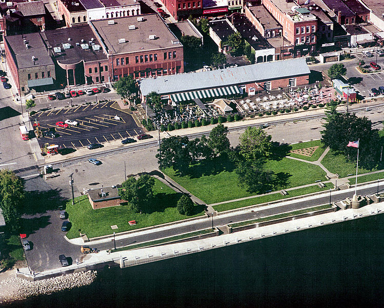
English: Aerial view of part of the waterfront section of Stillwater, Minnesota, USA, on the St. Croix River. View is to the west. The U.S. Army Corps of Engineers has constructed a floodwall along the waterfront. |
|||
| Dátum | Készült: 1999. augusztus 24. | |||
| Forrás |
U.S. Army Corps of Engineers Digital Visual Library Image page Image description page Digital Visual Library home page |
|||
| Szerző | U.S. Army Corps of Engineers, photographer not specified or unknown | |||
| Engedély (Fájl újrafelhasználása) |
|
|||
| Helyszín | Stillwater, Washington County, Minnesota, USA |
| Fényképező elhelyezkedése | | További képek erről a helyről: OpenStreetMap |
|---|
Fájltörténet
Kattints egy időpontra, hogy a fájl akkori állapotát láthasd.
| Dátum/idő | Bélyegkép | Felbontás | Feltöltő | Megjegyzés | |
|---|---|---|---|---|---|
| aktuális | 2007. április 7., 02:08 | | 1 500 × 1 201 (1,05 MB) | DanMS | {{Information | Description = {{en|Aerial view of part of the waterfront section of Stillwater, Minnesota, USA, on the St. Croix River. View is to the west. The U.S. Army Corps of Engineers has constructed a floodwall along the waterfront.}} | |
Fájlhasználat
Az alábbi lap használja ezt a fájlt:
Globális fájlhasználat
A következő wikik használják ezt a fájlt:
- Használata itt: ar.wikipedia.org
- Használata itt: arz.wikipedia.org
- Használata itt: azb.wikipedia.org
- Használata itt: ca.wikipedia.org
- Használata itt: ceb.wikipedia.org
- Használata itt: ce.wikipedia.org
- Használata itt: dag.wikipedia.org
- Használata itt: en.wikipedia.org
- Használata itt: en.wikivoyage.org
- Használata itt: es.wikipedia.org
- Használata itt: eu.wikipedia.org
- Használata itt: fa.wikipedia.org
- Használata itt: fi.wikipedia.org
- Használata itt: fr.wikipedia.org
- Használata itt: he.wikivoyage.org
- Használata itt: ht.wikipedia.org
- Használata itt: ko.wikipedia.org
- Használata itt: ky.wikipedia.org
- Használata itt: lld.wikipedia.org
- Használata itt: no.wikipedia.org
- Használata itt: pl.wikipedia.org
- Használata itt: ru.wikipedia.org
- Használata itt: sh.wikipedia.org
- Használata itt: sr.wikipedia.org
- Használata itt: sv.wikipedia.org
- Használata itt: tr.wikipedia.org
- Használata itt: tt.wikipedia.org
- Használata itt: uk.wikipedia.org
- Használata itt: uz.wikipedia.org
- Használata itt: vi.wikipedia.org
- Használata itt: vo.wikipedia.org
- Használata itt: www.wikidata.org
- Használata itt: zh-min-nan.wikipedia.org
- Használata itt: zh.wikipedia.org