
Fájl:Europe mediterranean 1097.jpg

Eredeti fájl (2 270 × 1 789 képpont, fájlméret: 4,85 MB, MIME-típus: image/jpeg)
|
Ez a fájl a Wikimedia Commonsból származik. Az alább látható leírás az ottani dokumentációjának másolata. A Commons projekt szabad licencű kép- és multimédiatár. Segíts te is az építésében! |


|
This map has been uploaded by Electionworld from en.wikipedia.org to enable the |
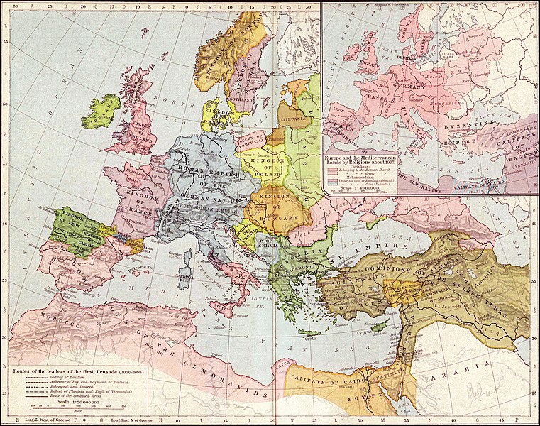
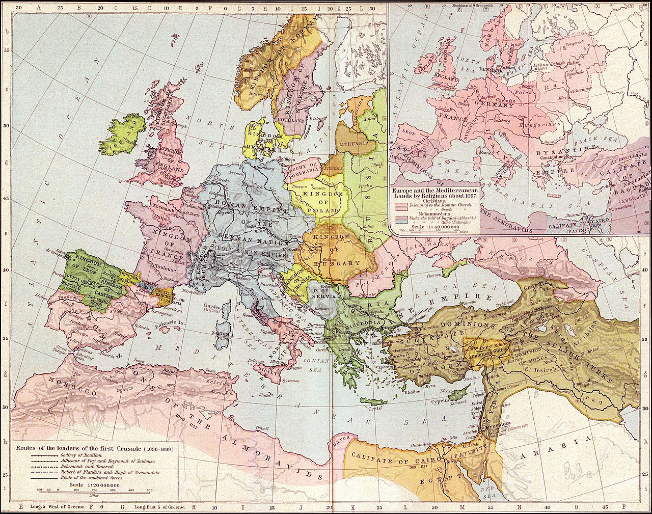
Map of Mediterranean and European lands anout 1097. Map from: Historical Atlas by William Shepherd (1923-26), in Public Domain
|
Ez a mű közkincs abban az országban, ahol elkészítették, és minden olyan további államban, ahol a szerzői jogi védelmi idő a szerző élete plusz 70 év vagy kevesebb.
| |
| Megállapították, hogy ez a fájl mentes mindenféle szerzői jogi korlátozástól, beleértve az összes kapcsolódó és hozzátartozó jogot. | |
.jpg)
Fájltörténet
Kattints egy időpontra, hogy a fájl akkori állapotát láthasd.
| Dátum/idő | Bélyegkép | Felbontás | Feltöltő | Megjegyzés | |
|---|---|---|---|---|---|
| aktuális | 2021. szeptember 27., 05:36 | | 2 270 × 1 789 (4,85 MB) | GPinkerton | Reverted to version as of 01:31, 30 January 2007 (UTC) do not alter historical maps! |
| 2020. június 26., 20:03 |  | 2 270 × 1 789 (4,84 MB) | Claude Zygiel | Map of Europe and Mediterranean lands about 1097: Byzantine Empire had not been completely excluded from Anatolia (Mantzikert, 1071) and the lower Danube was not pagan even if Pechenegs were Tengrists. | |
| 2007. január 30., 03:31 |  | 2 270 × 1 789 (4,85 MB) | Patrickneil | {{ew|en|Wirya}} Map of Kurdistan and Mediterranean and European lands anout 1097. Map from: [http://www.lib.utexas.edu/maps/historical/shepherd/europe_mediterranean_1097.jpg], in Public Domain {{PD-old}} | |
| 2006. december 3., 16:59 |  | 2 314 × 1 805 (725 KB) | Electionworld | {{ew|en|Wirya}} Map of Kurdistan and Mediterranean and European lands anout 1097. Map from: [http://www.lib.utexas.edu/maps/historical/shepherd/europe_mediterranean_1097.jpg], in Public Domain {{PD}} |
Fájlhasználat
Az alábbi lapok használják ezt a fájlt:
Globális fájlhasználat
A következő wikik használják ezt a fájlt:
- Használata itt: ast.wikipedia.org
- Használata itt: ba.wikipedia.org
- Használata itt: bg.wikipedia.org
- Használata itt: ce.wikipedia.org
- Használata itt: ckb.wikipedia.org
- Használata itt: de.wikipedia.org
- Használata itt: el.wikipedia.org
- Használata itt: en.wikipedia.org
- Használata itt: es.wikipedia.org
- Használata itt: et.wikipedia.org
- Használata itt: fa.wikipedia.org
- Használata itt: fr.wikipedia.org
- Használata itt: gl.wikipedia.org
- Használata itt: id.wikipedia.org
- Használata itt: it.wikipedia.org
- Használata itt: ms.wikipedia.org
- Használata itt: nn.wikipedia.org
- Használata itt: pnb.wikipedia.org
- Használata itt: pt.wikipedia.org
- Használata itt: ro.wikipedia.org
- Használata itt: ru.wikipedia.org
- Használata itt: ta.wikipedia.org
- Használata itt: tr.wikipedia.org
A fájl globális használatának megtekintése