
Fájl:China Xinjiang rel location map.svg

Eredeti fájl (SVG fájl, névlegesen 2 220 × 1 939 képpont, fájlméret: 1,46 MB)
|
Ez a fájl a Wikimedia Commonsból származik. Az alább látható leírás az ottani dokumentációjának másolata. A Commons projekt szabad licencű kép- és multimédiatár. Segíts te is az építésében! |
Összefoglaló
| Leírás |
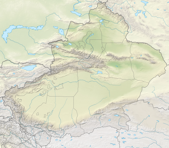
Deutsch: Positionskarte von Xinjiang, Volksrepublik China
English: Location map of Xinjiang, People's Republic of China
|
||||||||||||
| Dátum | |||||||||||||
| Forrás |
Own work using:
|
||||||||||||
| Szerző | NordNordWest | ||||||||||||
| Más változatok |
|
||||||||||||


|
Ezt a térképet a német Kartenwerkstatt készítette vagy javította. Te is javasolhatsz térképeket javításra.
|
Licenc
Usage of this file with:

explanatory notes: Legally binding is only the full legalcode. For a free usage I recommend to respect the following licence conditions:
1. Provide my name as given above: NordNordWest,
2. a copy of, or the URI for, the applicable license: https://creativecommons.org/licenses/by-sa/3.0/de/legalcode,
3. the title of the work,
4. in the case of an adaptation, a credit identifying the use of the work in the adaptation.
This license and the rights granted hereunder will terminate automatically upon any breach by you of the terms of this license. Any of the above conditions can be waived if you get permission from the copyright holder. If you have questions or wish differing conditions, please contact me through nnwest or my discussion page ![]() t-online.de
t-online.de
- A következőket teheted a művel:
- megoszthatod – szabadon másolhatod, terjesztheted, bemutathatod és előadhatod a művet
- feldolgozhatod – származékos műveket hozhatsz létre
- Az alábbi feltételekkel:
- Nevezd meg! – A szerzőt megfelelően fel kell tüntetned, hivatkozást kell létrehoznod a licencre és jelezned kell, ha a művön változtatást hajtottál végre. Ezt bármilyen észszerű módon megteheted, kivéve oly módon, ami azt sugallná hogy a jogosult támogat téged vagy a felhasználásod körülményeit.
- Így add tovább! – Ha megváltoztatod, átalakítod, feldolgozod ezt a művet, a közreműködésedet csak az eredetivel megegyező vagy hasonló licenc alatt terjesztheted.

Fájltörténet
Kattints egy időpontra, hogy a fájl akkori állapotát láthasd.
| Dátum/idő | Bélyegkép | Felbontás | Feltöltő | Megjegyzés | |
|---|---|---|---|---|---|
| aktuális | 2020. február 14., 22:05 | | 2 220 × 1 939 (1,46 MB) | NordNordWest | == {{int:filedesc}} == {{Information |Description= {{de|1=Positionskarte von Xinjiang, Volksrepublik China}} {{en|1=Location map of Xinjiang, People's Republic of China}} {{Location map series N |stretching=135 |top=49.4 |bottom=34.2 |left=73.2 |right=96.7 }} |Source={{Own using}} * United States National Imagery and Mapping Agency data * World Data Base II data * ETOPO1 data |Date=2020-02-14 |Author={{U|NordNordWest}} |Permission= |other_versions=<gallery>China Xinjiang adm location map.svg<... |
Fájlhasználat
Az alábbi lapok használják ezt a fájlt:
Globális fájlhasználat
A következő wikik használják ezt a fájlt:
- Használata itt: bh.wikipedia.org
- Használata itt: bn.wikipedia.org
- Használata itt: cv.wikipedia.org
- Használata itt: de.wikipedia.org
- Tocharische Sprachen
- Tian Shan
- Kongur
- Kunlun
- Khan Tengri
- Muztagata
- Lop Nor
- Dsungarische Pforte
- Altun
- Kanasi
- Bosten-See
- Turpan-Senke
- Karakol (See)
- Prschewalski-Gebirge
- Ulugh Muztagh
- Wuluwati-Talsperre
- Tiemen Guan
- Pulu-Vulkan
- Ashi-Vulkan
- Wikipedia:Kartenwerkstatt/Positionskarten/Asien
- Kumtag-Wüste (Dunhuang)
- Shaksgam-Tal
- Aydingkol-See
- Vorlage:Positionskarte China Xinjiang
- Ulungur-See
- Jilintai-Talsperre
- Tarbagataigebirge
- Saurgebirge
- Ebinur-See
- Sayram-See
- Bogda Shan
- Borochoro
- Birliktau
- Changtok Sar I
- Sarpo-Laggo-Gletscher
- Urdokgletscher
- Nördlicher Gasherbrumgletscher
- Skamrigletscher
- Kongur Jiubie
- Kotaklik Shan
- Selik Gulam Muztag
- Bukadabang Feng
- Aksai Chin (See)
- Chakragil
- Koskulak Tagh
- Kokosel Tagh
A fájl globális használatának megtekintése