
Fájl:Autobahn Notlandeplatz A29 Ahlhorn DoD DF-ST-85-05075.jpg
Az előnézet mérete: 434 × 599 képpont További felbontások: 174 × 240 képpont | 348 × 480 képpont | 556 × 768 képpont | 742 × 1 024 képpont | 1 878 × 2 593 képpont.
Eredeti fájl (1 878 × 2 593 képpont, fájlméret: 3,36 MB, MIME-típus: image/jpeg)
|
Ez a fájl a Wikimedia Commonsból származik. Az alább látható leírás az ottani dokumentációjának másolata. A Commons projekt szabad licencű kép- és multimédiatár. Segíts te is az építésében! |
Összefoglaló
| Leírás |
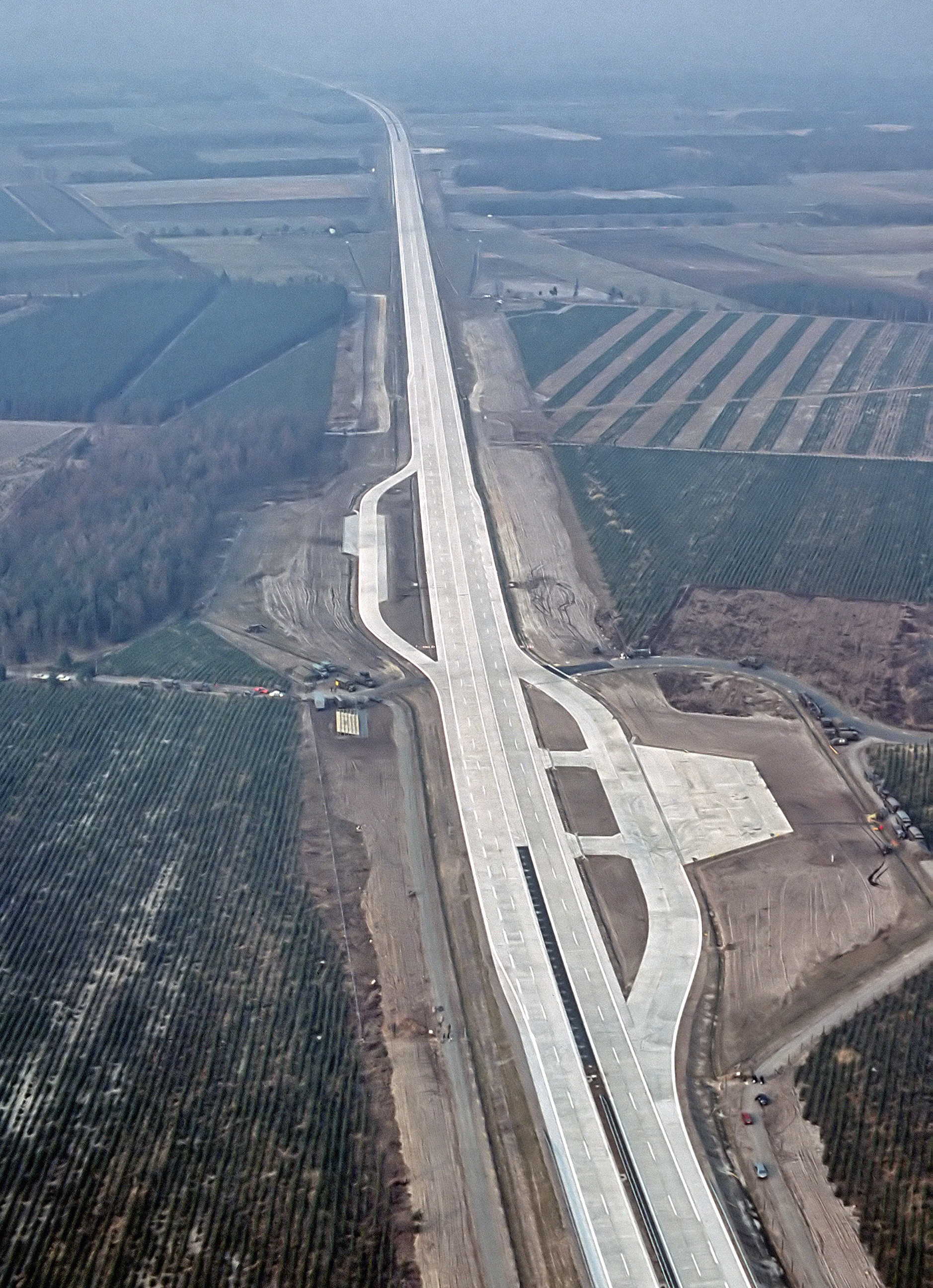
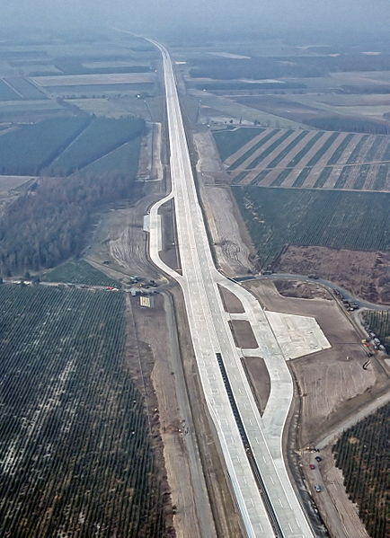
English: An aerial view of the autobahn A29 near Ahlhorn, Germany. Construction of A29 completed in 1984, the emergency-runway had been in the initial design. The highway had been cleared of traffic to allow it to be used to land aircraft during NATO exercise "highway 84".
Deutsch: Luftbild der Bundesautobahn A29 in der Nähe von Ahlhorn im Jahr ihrer Fertigstellung. Im Rahmen der Nato-Übung "Highway 84" wurde der Notlandeplatz genutzt. |
|||
| Dátum | ||||
| Forrás |
|
|||
| Szerző | TSgt. Rod Prouty, USAF | |||
| Engedély (Fájl újrafelhasználása) |
Released to Public Photo ID:DF-ST-85-05075 |
| Fényképező elhelyezkedése | | További képek erről a helyről: OpenStreetMap |
|---|
Licenc
This image or file is a work of a U.S. Air Force Airman or employee, taken or made as part of that person's official duties. As a work of the U.S. federal government, the image or file is in the public domain in the United States.
|
 |
Fájltörténet
Kattints egy időpontra, hogy a fájl akkori állapotát láthasd.
| Dátum/idő | Bélyegkép | Felbontás | Feltöltő | Megjegyzés | |
|---|---|---|---|---|---|
| aktuális | 2007. augusztus 4., 08:12 | | 1 878 × 2 593 (3,36 MB) | -jha- | {{Information |Description={{en|An aerial view of the autobahn A29 near Ahlhorn. construction of A29 just completed in 1984, the emergency-runway has been in the initial design. The highway has been cleared of traffic to allow it to be used to land aircr |
Fájlhasználat
Az alábbi lapok használják ezt a fájlt:
Globális fájlhasználat
A következő wikik használják ezt a fájlt:
- Használata itt: de.wikipedia.org
- Használata itt: de.wikivoyage.org
- Használata itt: en.wikipedia.org
- Használata itt: fa.wikipedia.org
- Használata itt: fr.wikipedia.org
- Használata itt: fy.wikipedia.org
- Használata itt: he.wikipedia.org
- Használata itt: it.wikipedia.org
- Használata itt: ja.wikipedia.org
- Használata itt: nds.wikipedia.org
- Használata itt: nl.wikipedia.org
- Használata itt: pl.wikipedia.org
- Használata itt: sv.wikipedia.org
- Használata itt: th.wikipedia.org
- Használata itt: tr.wikipedia.org
- Használata itt: zh.wikipedia.org