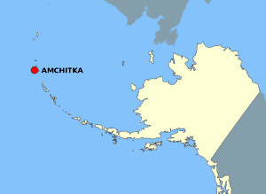
Fájl:AmchitkaAlaskaLoc.png

Az oldal más nyelven nem érhető el.
A Wikipédiából, a szabad enciklopédiából

AmchitkaAlaskaLoc.png(300 × 219 képpont, fájlméret: 14 KB, MIME-típus: image/png)

Összefoglaló

Leírás

This map is a derivative work of a map layer from nationalatlas.gov, which states: "We have begun by collaboratively building "frameworks," the essential map layers that provide a foundation for all other maps. These basic layers, including small-scale harmonized information on North American roads, water, boundaries and the like, are being offered here for the first time. Like all other raw data and documentation offered here on nationalatlas.gov, these frameworks can be downloaded at no cost and used freely without copyright concerns or license restrictions."[1]

I donate the modifications and the resulting work to the public domain.
Forrás see above
Szerző National Atlas - DW: Jakew

Licenc

Public domain
This map was obtained from an edition of the National Atlas of the United States. Like almost all works of the U.S. federal government, works from the National Atlas are in the public domain in the United States.
Online access: NationalAtlas.gov | 1970 print edition: Library of Congress, Perry-Castañeda Library

čeština | Deutsch | English | français | Bahasa Indonesia | italiano | македонски | മലയാളം | sicilianu | 中文 | 中文(简体)‎ | 中文(繁體)‎ | +/−

Eredeti feltöltési napló

Az eredeti leírólap itt volt. Az itt következő felhasználónevek az en.wikipedia projektre hivatkoznak.
  • 2006-10-08 16:15 Jakew 300×219×8 (14678 bytes) This map is a derivative work of a map layer from nationalatlas.gov, which states: "We have begun by collaboratively building "frameworks," the essential map layers that provide a foundation for all other maps. These basic layers, including small-scale ha

Képaláírások

Adj meg egy egysoros magyarázatot arról, hogy mit mutat be ez a fájl

A fájl által ábrázolt elemek

mű tárgya

29373e1014db60b020fe042aeb20de37cd506fdd

14 678 byte

219 képpont

300 képpont

Fájltörténet

Kattints egy időpontra, hogy a fájl akkori állapotát láthasd.

Dátum/időBélyegképFelbontásFeltöltőMegjegyzés
aktuális2007. augusztus 2., 23:20Bélyegkép a 2007. augusztus 2., 23:20-kori változatról300 × 219 (14 KB)Adam~commonswiki{{Information |Description=This map is a derivative work of a map layer from nationalatlas.gov, which states: "We have begun by collaboratively building "frameworks," the essential map layers that provide a foundation for all other maps. These basic layer

Az alábbi lap használja ezt a fájlt:

Globális fájlhasználat

A következő wikik használják ezt a fájlt: