
Fájl:St. Johns, Arizona (101310387).jpg

Eredeti fájl (1 600 × 1 200 képpont, fájlméret: 610 KB, MIME-típus: image/jpeg)
|
Ez a fájl a Wikimedia Commonsból származik. Az alább látható leírás az ottani dokumentációjának másolata. A Commons projekt szabad licencű kép- és multimédiatár. Segíts te is az építésében! |
.jpg)
Összefoglaló
| Leírás |
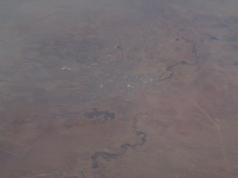
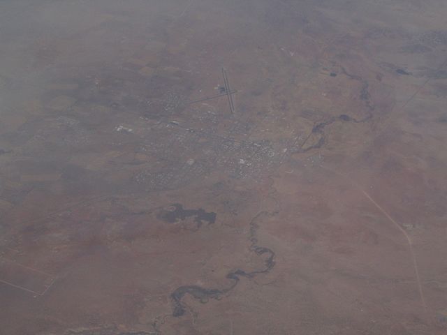
St. Johns is the only city in and the county seat of Apache County, Arizona, United States. It is located along U.S. Route 180, mostly west of where that highway intersects with U.S. Route 191. According to 2006 Census Bureau estimates, the population of the city was 3,538. St. Johns was first settled in 1873 by the Barth Brothers. They were bought out in 1879 by Ammon M. Tenney. St. Johns has been the county seat for almost all of the county's history. When the county was created on February 24, 1879, Snowflake was designated the county seat. After the first election in fall 1879, county government was set up in St. Johns, though it was moved again in 1880, to Springerville; in 1882 St. Johns again became the county seat, and it has remained so ever since. St. Johns is home to the Apache County Historical Society Museum and has four National Register of Historic Places: Isaacson Building, Lower Zuni River Archeological District, Lyman Lake Rock Art Site, and Rattlesnake Point Pueblo. St. Johns is near the Placerias Quarry, the site where dozens of Placerias fossils were discovered in 1930 by Charles Camp and Samuel Welles, of the University of California, Berkeley. St. Johns is along the shortest and most scenic route from Phoenix to Albuquerque, New Mexico. Within an hour's drive from St. John's are Apache-Sitgreaves National Forest, Petrified Forest National Park, the Painted Desert, and Lyman Lake State Park, as well as Indian reservations such as the Navajo Nation, Fort Apache Indian Reservation, San Carlos Apache Indian Reservation, and Zuni Indian Reservation. en.wikipedia.org/wiki/St._Johns,_Arizona en.wikipedia.org/wiki/Wikipedia:Text_of_Creative_Commons_... |
| Dátum | |
| Forrás | St. Johns, Arizona |
| Szerző | Ken Lund from Reno, Nevada, USA |
| Fényképező elhelyezkedése | | További képek erről a helyről: OpenStreetMap |
|---|
.jpg¶ms=034.506910_N_-109.361858_E_globe:Earth_type:camera_source:Flickr_&language=hu)
Licenc
- A következőket teheted a művel:
- megoszthatod – szabadon másolhatod, terjesztheted, bemutathatod és előadhatod a művet
- feldolgozhatod – származékos műveket hozhatsz létre
- Az alábbi feltételekkel:
- Nevezd meg! – A szerzőt megfelelően fel kell tüntetned, hivatkozást kell létrehoznod a licencre és jelezned kell, ha a művön változtatást hajtottál végre. Ezt bármilyen észszerű módon megteheted, kivéve oly módon, ami azt sugallná hogy a jogosult támogat téged vagy a felhasználásod körülményeit.
- Így add tovább! – Ha megváltoztatod, átalakítod, feldolgozod ezt a művet, a közreműködésedet csak az eredetivel megegyező vagy hasonló licenc alatt terjesztheted.
| This image was originally posted to Flickr by Ken Lund at https://flickr.com/photos/75683070@N00/101310387. It was reviewed on 2015. december 3. by FlickreviewR and was confirmed to be licensed under the terms of the cc-by-sa-2.0. |
Fájltörténet
Kattints egy időpontra, hogy a fájl akkori állapotát láthasd.
| Dátum/idő | Bélyegkép | Felbontás | Feltöltő | Megjegyzés | |
|---|---|---|---|---|---|
| aktuális | 2015. december 3., 23:43 | | 1 600 × 1 200 (610 KB) | INeverCry | Transferred from Flickr via Flickr2Commons |
Fájlhasználat
Az alábbi lap használja ezt a fájlt:
Globális fájlhasználat
A következő wikik használják ezt a fájlt:
- Használata itt: ar.wikipedia.org
- Használata itt: arz.wikipedia.org
- Használata itt: bg.wikipedia.org
- Használata itt: ca.wikipedia.org
- Használata itt: ceb.wikipedia.org
- Használata itt: ce.wikipedia.org
- Használata itt: cy.wikipedia.org
- Használata itt: es.wikipedia.org
- Használata itt: eu.wikipedia.org
- Használata itt: he.wikipedia.org
- Használata itt: ht.wikipedia.org
- Használata itt: it.wikipedia.org
- Használata itt: lld.wikipedia.org
- Használata itt: no.wikipedia.org
- Használata itt: pl.wikipedia.org
- Használata itt: pt.wikipedia.org
- Használata itt: ro.wikipedia.org
- Használata itt: sr.wikipedia.org
- Használata itt: tt.wikipedia.org
- Használata itt: uz.wikipedia.org
- Használata itt: vo.wikipedia.org
- Használata itt: www.wikidata.org
.jpg)