
Fájl:Aerial view of Nauru.jpg
Az előnézet mérete: 800 × 587 képpont További felbontások: 320 × 235 képpont | 640 × 469 képpont | 1 024 × 751 képpont | 1 280 × 938 képpont | 1 600 × 1 173 képpont.
Eredeti fájl (1 600 × 1 173 képpont, fájlméret: 545 KB, MIME-típus: image/jpeg)
|
Ez a fájl a Wikimedia Commonsból származik. Az alább látható leírás az ottani dokumentációjának másolata. A Commons projekt szabad licencű kép- és multimédiatár. Segíts te is az építésében! |
Összefoglaló
| Leírás |
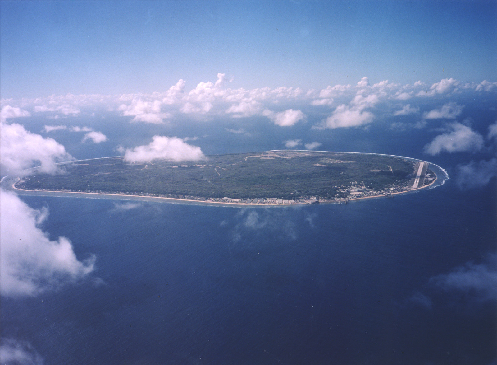
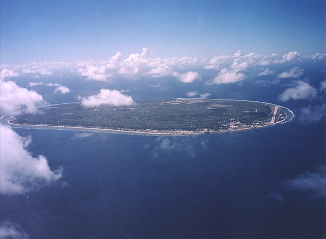
English: A limestone karst on Nauru Island as a result of the over-mining of phosphate. |
| Dátum | |
| Forrás | https://www.flickr.com/photos/armgov/4708951747/ |
| Szerző | U.S. Department of Energy's Atmospheric Radiation Measurement Program |
Licenc
This photograph was produced by the Atmospheric Radiation Measurement Program.
Their site states:
|
Fájltörténet
Kattints egy időpontra, hogy a fájl akkori állapotát láthasd.
| Dátum/idő | Bélyegkép | Felbontás | Feltöltő | Megjegyzés | |
|---|---|---|---|---|---|
| aktuális | 2023. április 29., 00:53 | | 1 600 × 1 173 (545 KB) | Auguel | Cropped 1 % vertically using CropTool with lossless mode. |
| 2007. április 3., 04:13 |  | 1 600 × 1 187 (401 KB) | Indolences | A limestone karst on Nauru Island as a result of the over-mining of phosphate. ''Courtesy: U.S. Department of Energy's Atmospheric Radiation Measurement Program.'' Source: [http://images.arm.gov/armimages.nsf/by+id/TENG-5JGSKP] (http://www.arm.gov/) {{ |
Fájlhasználat
Az alábbi lapok használják ezt a fájlt:
Globális fájlhasználat
A következő wikik használják ezt a fájlt:
- Használata itt: ar.wikipedia.org
- Használata itt: as.wikipedia.org
- Használata itt: bg.wikipedia.org
- Használata itt: de.wikipedia.org
- Használata itt: dsb.wikipedia.org
- Használata itt: en.wikipedia.org
- Használata itt: en.wikiversity.org
- Használata itt: es.wikipedia.org
- Használata itt: fr.wikipedia.org
- Használata itt: fr.wiktionary.org
- Használata itt: he.wikivoyage.org
- Használata itt: hsb.wikipedia.org
- Használata itt: hy.wikipedia.org
- Használata itt: id.wikipedia.org
- Használata itt: incubator.wikimedia.org
- Használata itt: lv.wikipedia.org
- Használata itt: ms.wikipedia.org
- Használata itt: na.wikipedia.org
- Használata itt: nl.wikivoyage.org
- Használata itt: pl.wikipedia.org
- Használata itt: pt.wikivoyage.org
- Használata itt: ru.wikipedia.org
- Használata itt: ru.wikivoyage.org
- Használata itt: simple.wikipedia.org
- Használata itt: si.wikipedia.org
- Használata itt: ta.wikipedia.org
- Használata itt: test.wikipedia.org
- Használata itt: th.wikipedia.org
- Használata itt: tr.wikipedia.org
- Használata itt: uk.wikipedia.org
- Használata itt: vec.wikipedia.org
- Használata itt: vi.wikipedia.org
- Használata itt: vi.wikivoyage.org