
Fájl:USACE Divide Cut map large.png
Az előnézet mérete: 800 × 522 képpont További felbontások: 320 × 209 képpont | 640 × 418 képpont | 1 024 × 669 képpont | 1 280 × 836 képpont | 1 902 × 1 242 képpont.
Eredeti fájl (1 902 × 1 242 képpont, fájlméret: 560 KB, MIME-típus: image/png)
|
Ez a fájl a Wikimedia Commonsból származik. Az alább látható leírás az ottani dokumentációjának másolata. A Commons projekt szabad licencű kép- és multimédiatár. Segíts te is az építésében! |
| Leírás |
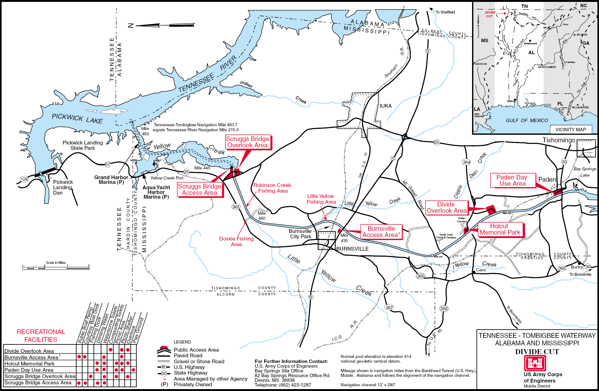
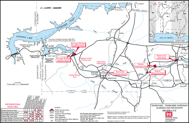
English: Detailed map of the Divide Cut on the Tennessee-Tombigbee Waterway in the U.S. State of Mississippi. PDF file saved as PNG. |
|||
| Helyszín | Mississippi, USA | |||
| Dátum | not specified or unknown | |||
| Forrás |
U.S. Army Corps of Engineers Image page (PDF) Map description page |
|||
| Szerző | U.S. Army Corps of Engineers, artist not specified or unknown | |||
| Engedély (Fájl újrafelhasználása) |
|
Fájltörténet
Kattints egy időpontra, hogy a fájl akkori állapotát láthasd.
| Dátum/idő | Bélyegkép | Felbontás | Feltöltő | Megjegyzés | |
|---|---|---|---|---|---|
| aktuális | 2007. március 25., 23:09 | | 1 902 × 1 242 (560 KB) | DanMS | {{Information | Description = {{en|Detailed map of the Divide Cut on the Tennessee-Tombigbee Waterway in the U.S. State of Mississippi. PDF file saved as PNG.}} | Source = U.S. Army Corps of Engineers<br />[http://tenntom.sam.usace.army.mil/pdf |
Fájlhasználat
Az alábbi lap használja ezt a fájlt:
Globális fájlhasználat
A következő wikik használják ezt a fájlt:
- Használata itt: en.wikipedia.org