
Fájl:1945-02-15GerWW2BattlefrontAtlas.jpg
Az előnézet mérete: 616 × 600 képpont További felbontások: 247 × 240 képpont | 493 × 480 képpont | 789 × 768 képpont | 1 250 × 1 217 képpont.
Eredeti fájl (1 250 × 1 217 képpont, fájlméret: 1,26 MB, MIME-típus: image/jpeg)
|
Ez a fájl a Wikimedia Commonsból származik. Az alább látható leírás az ottani dokumentációjának másolata. A Commons projekt szabad licencű kép- és multimédiatár. Segíts te is az építésében! |

|
Ezt a fájlt felváltotta a File:1945-02-15GerWW2BattlefrontAtlas reworked.jpg. A másik fájl használata ajánlott.
|

|
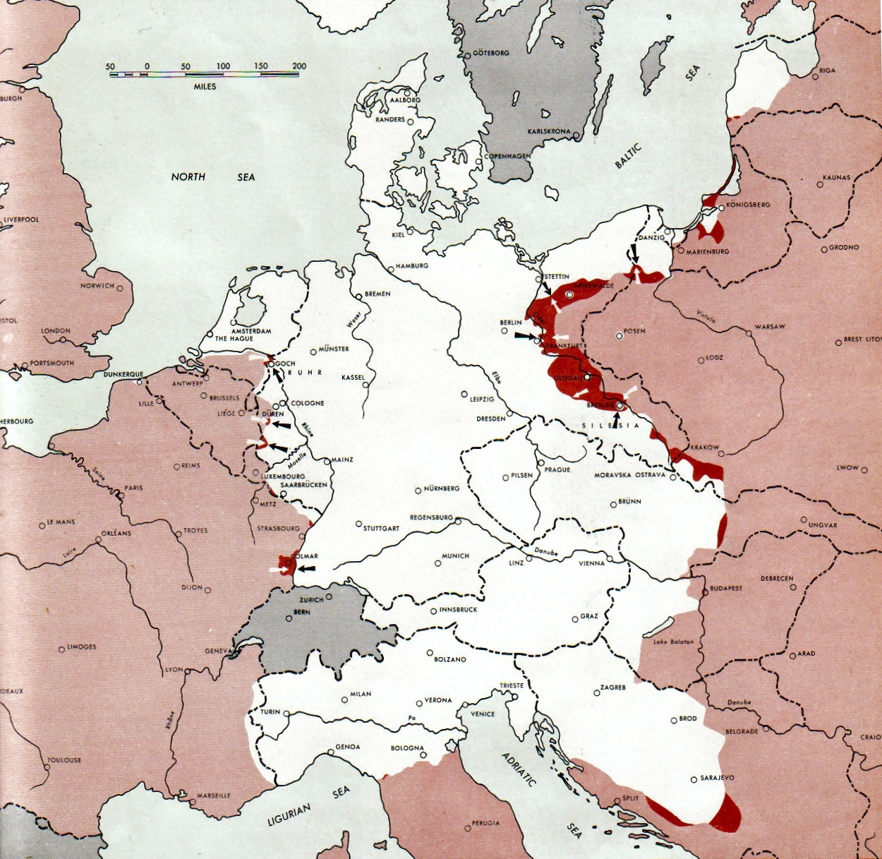
Atlas of the World Battle Fronts - War against Germany: 1945-02-15
← Previous map: 1945-02-01
→ Next map: 1945-03-01
Összefoglaló
| Leírás |
Neutral nations (Sweden, Switzerland, Spain, Andorra)
Under Allied control
Allied forces
Axis forces or control
  July 1, 1943 to June 30 1945 To the Secretary of War". (See Cover, Forward and Map details)  |
| Dátum | |
| Forrás | Document "Atlas of the World Battle Fronts in Semimonthly Phases to August 15th 1945: Supplement to The Biennial report of the Chief of Staff of the United States Army July 1, 1943 to June 30 1945 To the Secretary of War" |
| Szerző | Army Map Service |
| Engedély (Fájl újrafelhasználása) |
Public Domain: Work of US army |
Licenc
Ezt a képet az Amerikai Egyesült Államok Szárazföldi Erőinek egy katonája vagy munkatársa készítette szolgálati ideje alatt. Az Egyesült Államok jogszabályai értelmében ez a kép közkincsnek minősül.
|
 |
Fájltörténet
Kattints egy időpontra, hogy a fájl akkori állapotát láthasd.
| Dátum/idő | Bélyegkép | Felbontás | Feltöltő | Megjegyzés | |
|---|---|---|---|---|---|
| aktuális | 2011. augusztus 28., 11:15 | | 1 250 × 1 217 (1,26 MB) | Finavon | 1 degree rotation; caption cropped |
| 2007. december 24., 21:16 |  | 1 274 × 1 714 (1,78 MB) | Mike Young | {{Information |Description= thumb|left|75pxthumb|right|75pxMap of the front against Germany: This map is taken from the source "Atlas of the World Battle Fronts in Semimonthly |
Fájlhasználat
Az alábbi lap használja ezt a fájlt:
Globális fájlhasználat
A következő wikik használják ezt a fájlt:
- Használata itt: be-tarask.wikipedia.org
- Használata itt: da.wikipedia.org
- Használata itt: en.wikipedia.org
- Használata itt: en.wikisource.org
- Használata itt: es.wikipedia.org
- Használata itt: hy.wikipedia.org
- Használata itt: id.wikipedia.org
- Használata itt: ko.wikipedia.org
- Használata itt: no.wikipedia.org
- Használata itt: ro.wikipedia.org
- Használata itt: vi.wikipedia.org
- Használata itt: zh.wikipedia.org